Drury, Kansas facts for kids
Quick facts for kids
Drury, Kansas
|
|
|---|---|

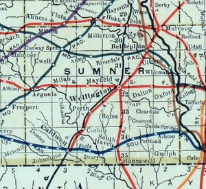
1915 Railroad Map of Sumner County
|
|

|
|
| Country | United States |
| State | Kansas |
| County | Sumner |
| Township | Falls |
| Elevation | 1,093 ft (333 m) |
| Time zone | UTC-6 (CST) |
| • Summer (DST) | UTC-5 (CDT) |
| Area code | 620 |
| FIPS code | 20-18725 |
| GNIS ID | 470077 |
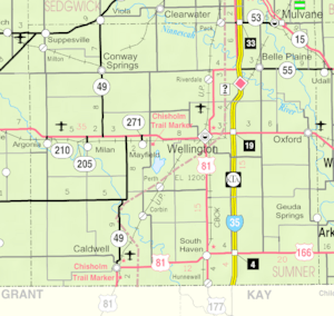
Drury is a small, quiet place in Sumner County, Kansas, United States. It's called an unincorporated community, which means it doesn't have its own local government like a city does. You can find Drury in Falls Township, located between the towns of South Haven and Caldwell. It's right near where S Drury Road meets W 175th Street S, close to the Chikaskia River and an old, unused railroad track.
History of Drury
Drury used to be an important stop on the Kansas Southwestern Railway. This railway line ran through the community from east to west. It connected Drury to nearby towns like South Haven and Caldwell.
For many years, Drury had its own post office. It opened in 1884 and served the community until 1921. This was a key way for people to send and receive mail.
Did you know a movie was filmed here? The film Americana was shot in Drury.
Education in the Community
Students living in Drury attend public schools. The community is part of the Caldwell USD 360 public school district. This district provides education for children in the area.
 | Charles R. Drew |
 | Benjamin Banneker |
 | Jane C. Wright |
 | Roger Arliner Young |


