Dry Canyon Reservoir facts for kids
Quick facts for kids Dry Canyon Reservoir |
|
|---|---|
 |
|
| Location | Los Angeles County, California |
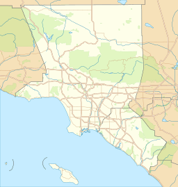
| Coordinates | 34°29′04″N 118°31′44″W / 34.4845°N 118.5290°W |
| Type | reservoir |
| Primary inflows | Los Angeles Aqueduct Dry Canyon Creek |
| Primary outflows | Los Angeles Aqueduct Dry Canyon Creek |
| Max. length | 780 feet (240 m) |
| Water volume | 72,750 cu ft (2,060 m3) |
| Surface elevation | 1,455 feet (443 m) |
| Islands | None |
| Settlements | Santa Clarita |
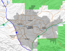
Dry Canyon Reservoir is a small lake in northern Los Angeles County, California. It is located near the city of Santa Clarita. This reservoir was built as an important part of the Los Angeles Aqueduct system. The aqueduct helps bring water to the greater Los Angeles area.
History of Dry Canyon Reservoir
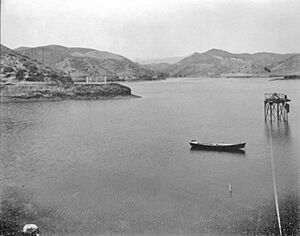
The Dry Canyon Reservoir was built between 1910 and 1912. It was designed to hold about 72,750 cu ft (2,060 m3) of water. The lake's surface was about 1,514 feet (461 m) above sea level.
How the Reservoir Worked
The main job of the reservoir was to control the flow of water. This water came from power plants in San Francisquito Canyon. The water entered the reservoir through a passage called Tunnel 77. After being held in the reservoir, the water left through Tunnel 78. From there, it continued its journey through the Los Angeles Aqueduct. This water was then sent to the northern parts of the Greater Los Angeles Area.
Why the Reservoir Was Drained
In 1966, the Dry Canyon Reservoir was emptied. This happened after the dam was damaged during the 1952 Kern County earthquake. People also worried about how strong the dam was.
Since the early 1970s, there were ideas to fill the reservoir again. However, these plans were stopped because it would cost too much money. Over the years, the communities around Santa Clarita grew. They expanded northward into the valley below the dam.
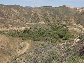
Today, the reservoir is empty. It is now used to help control floods during big storms. The old lakebed is covered with oak trees and other plants.
 | Claudette Colvin |
 | Myrlie Evers-Williams |
 | Alberta Odell Jones |


