Dry Prong, Louisiana facts for kids
Quick facts for kids
Dry Prong, Louisiana
|
|
|---|---|
|
Village
|
|

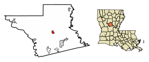
Location of Dry Prong in Grant Parish, Louisiana.
|
|

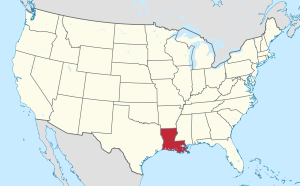
Location of Louisiana in the United States
|
|
| Country | United States |
| State | Louisiana |
| Parish | Grant |
| Area | |
| • Total | 1.40 sq mi (3.62 km2) |
| • Land | 1.39 sq mi (3.59 km2) |
| • Water | 0.01 sq mi (0.03 km2) |
| Elevation | 230 ft (70 m) |
| Population
(2020)
|
|
| • Total | 455 |
| • Density | 328.28/sq mi (126.75/km2) |
| Time zone | UTC-6 (CST) |
| • Summer (DST) | UTC-5 (CDT) |
| Area code(s) | 318 |
| FIPS code | 22-21765 |
Dry Prong is a small village located in the middle of Grant Parish, Louisiana, in the United States. It is part of the larger Alexandria, Louisiana area. In 2020, about 455 people lived there.
Contents
History of Dry Prong
Dry Prong became an official village in 1945.
How Dry Prong Got Its Name
The village's name comes from an old story. Around the 1870s, a family moved to this area. They wanted to build a sawmill that used a water wheel for power. They built it over a creek, but they soon found out that the creek dried up every summer! It was a "dry prong" of water.
They quickly moved the mill to another creek that flowed all year. But the name "Dry Prong" stuck for the area. Today, the original "dry prong" creek is outside the village limits, near Highway 123. Shane Davis is the current mayor of Dry Prong.
Geography of Dry Prong
Dry Prong is right in the center of Grant Parish. It is located at 31°34′44″N 92°31′46″W / 31.57889°N 92.52944°W. U.S. Route 167 goes through the village. This road leads north about 26 miles to Winnfield. It also goes south about 22 miles to Alexandria. The village is also located within the Kisatchie National Forest.
The village covers about 1.40 square miles (3.62 square kilometers). Most of this area is land. Only a tiny part, about 0.01 square miles (0.03 square kilometers), is water.
Main Roads in Dry Prong
Population of Dry Prong
| Historical population | |||
|---|---|---|---|
| Census | Pop. | %± | |
| 1950 | 377 | — | |
| 1960 | 360 | −4.5% | |
| 1970 | 352 | −2.2% | |
| 1980 | 526 | 49.4% | |
| 1990 | 380 | −27.8% | |
| 2000 | 421 | 10.8% | |
| 2010 | 436 | 3.6% | |
| 2020 | 455 | 4.4% | |
| U.S. Decennial Census | |||
According to the 2000 census, 421 people lived in Dry Prong. Most people in the village were White (95.25%). A small number were African American (0.95%) or Native American (0.24%). Some people were from other backgrounds (1.66%) or a mix of two or more races (1.90%). About 2.61% of the population was Hispanic or Latino.
In 2000, about 30.7% of homes had children under 18 living there. The average household had about 2.39 people. The average family had about 2.91 people.
The population was spread out by age. About 25.7% were under 18 years old. About 15.2% were 65 years or older. The average age in the village was 40 years old.
Education in Dry Prong
Students living in Dry Prong go to schools managed by the Grant Parish School Board.
Media in Dry Prong
- KVDP (FM), a local radio station that broadcasts on 89.1 FM.
Notable People from Dry Prong
- W. K. Brown: He grew up in Dry Prong. He served as a state representative from 1960 to 1972.
- Billy Chandler: He was a state representative for Grant, La Salle, and Winn parishes from 2006 to 2012.
- Leonard R. "Pop" Hataway: He was the sheriff of Grant Parish for many years, from 1976 to 2008. He was also a member of the Louisiana Board of Pardons and Paroles. He is recognized in the Louisiana Political Museum and Hall of Fame.
See also
In Spanish: Dry Prong para niños
 | Charles R. Drew |
 | Benjamin Banneker |
 | Jane C. Wright |
 | Roger Arliner Young |

