Winn Parish, Louisiana facts for kids
Quick facts for kids
Winn Parish, Louisiana
|
|
|---|---|
| Parish of Winn | |

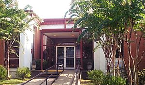
Winn Parish Courthouse in Winnfield
|
|

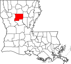
Location within the U.S. state of Louisiana
|
|

Louisiana's location within the US
|
|
| Country | |
| State | |
| Region | North Louisiana |
| Founded | February 24, 1852 |
| Named for | Walter Winn or Winfield Scott |
| Parish seat (and largest city) | Winnfield |
| Incorporated municipalities |
6 (total)
1 city, 1 town, and 4 villages
|
| Area | |
| • Total | 2,480 km2 (957 sq mi) |
| • Land | 2,500 km2 (950 sq mi) |
| • Water | 17 km2 (6.7 sq mi) 0.7% |
| Population
(2020)
|
|
| • Total | 13,755 |
| Time zone | UTC-6 (CST) |
| • Summer (DST) | UTC-5 (CDT) |
| Area code | 318 |
| Congressional district | 5th |
Winn Parish is a special kind of county called a parish in the state of Louisiana, USA. In 2020, about 13,755 people lived here. The main town and biggest city is Winnfield.
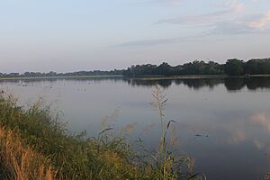
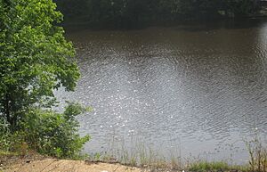
Winn Parish was created in 1852. It is the very last parish in Louisiana when you list them alphabetically. A special waterway called Saline Bayou separates Winn Parish from Natchitoches Parish. Saline Bayou is known as the first "blackwater" river in the southern USA to be protected.
Contents
A Look Back: History of Winn Parish

Winn Parish was formed in 1852. Its land came from parts of three other parishes: Catahoula, Natchitoches, and Rapides.
During the Civil War, a young lawyer named David Pierson represented Winn Parish. He voted against Louisiana leaving the United States. Many people in Winn Parish supported the Union, which was the northern side in the war.
After the war, some groups of bandits caused trouble. They robbed travelers on roads like the Natchez Trace. The West and Kimbrell families were among the most well-known of these groups.
In 1873, a difficult event happened in nearby Grant Parish. It was called the Colfax massacre. This conflict involved groups of white and Black citizens after a disagreement about an election. It was a very sad time in the area's history.
Where is Winn Parish? Geography
Winn Parish covers a total area of about 957 square miles. Most of this area, 950 square miles, is land. The remaining 6.7 square miles, or 0.7%, is water.
Main Roads You Can Drive On
Neighboring Parishes
- Jackson Parish (north)
- Caldwell Parish (northeast)
- La Salle Parish (southeast)
- Grant Parish (south)
- Natchitoches Parish (west)
- Bienville Parish (northwest)
Special Protected Areas
- Kisatchie National Forest (part of it is in Winn Parish)
- Saline Bayou
Towns and Villages: Communities in Winn Parish
City
- Winnfield (This is the main town and the biggest one.)
Town
- Tullos (Part of this town is in Winn Parish.)
Villages
Other Areas (Not Officially Cities or Towns)
Census-designated places
Other communities
- Packton
- Tannehill
- Wheeling
Who Lives Here? Demographics
| Historical population | |||
|---|---|---|---|
| Census | Pop. | %± | |
| 1860 | 6,876 | — | |
| 1870 | 4,954 | −28.0% | |
| 1880 | 5,846 | 18.0% | |
| 1890 | 7,082 | 21.1% | |
| 1900 | 9,648 | 36.2% | |
| 1910 | 18,357 | 90.3% | |
| 1920 | 16,119 | −12.2% | |
| 1930 | 14,766 | −8.4% | |
| 1940 | 16,923 | 14.6% | |
| 1950 | 16,119 | −4.8% | |
| 1960 | 16,034 | −0.5% | |
| 1970 | 16,369 | 2.1% | |
| 1980 | 17,253 | 5.4% | |
| 1990 | 16,269 | −5.7% | |
| 2000 | 16,894 | 3.8% | |
| 2010 | 15,313 | −9.4% | |
| 2020 | 13,755 | −10.2% | |
| U.S. Decennial Census 1790–1960 1900–1990 1990–2000 2010 |
|||
| Race | Number | Percentage |
|---|---|---|
| White (not Hispanic) | 8,498 | 61.78% |
| Black or African American (not Hispanic) | 3,518 | 25.58% |
| Native American | 77 | 0.56% |
| Asian | 172 | 1.25% |
| Pacific Islander | 16 | 0.12% |
| Other/Mixed | 451 | 3.28% |
| Hispanic or Latino | 1,023 | 7.44% |
In 2020, there were 13,755 people living in Winn Parish. There were 5,483 households and 3,661 families.
Learning in Winn Parish: Education
The Winn Parish School Board is in charge of the public schools in the parish.
Corrections Facilities
The Winn Correctional Center is located in an area of Winn Parish that is not part of any city or town.
Military Presence: National Guard
A unit of the Louisiana National Guard used to be in Winnfield. This unit was part of the 199th Forward Support Battalion. They went to Iraq twice, in 2004-2005 and 2010, as part of a larger military team. The building where they were based, called the Winnfield Armory, is now closed.
Famous People from Winn Parish
Winn Parish is known for being the home of three Louisiana governors:
- O.K. Allen
- Huey Long
- Earl Kemp Long
See also
 In Spanish: Parroquia de Winn para niños
 | Roy Wilkins |
 | John Lewis |
 | Linda Carol Brown |


