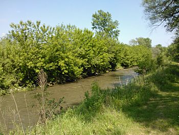
Duck Creek (Quad Cities) facts for kids
Quick facts for kids Duck Creek |
|
|---|---|

Duck Creek in Davenport
|
|
| Country | United States |
| State | Iowa |
| Physical characteristics | |
| Main source | Scott County, Iowa 41°32′57″N 90°44′57″W / 41.54917°N 90.74917°W |
| River mouth | Mississippi River 41°31′25″N 90°28′30″W / 41.52361°N 90.47500°W |
Duck Creek is a small river, also called a creek, that flows into the much larger Mississippi River in the United States. This creek runs through Scott County, Iowa, and the cities of Davenport, Bettendorf, and Riverdale. It's an important part of the local environment and community.
Contents
Exploring Duck Creek
Duck Creek starts in the countryside areas north of Blue Grass. It then flows east and empties into the Mississippi River between Bettendorf and Riverdale. The creek is about 19 miles (30.6 kilometers) long. This makes it the biggest creek in the Quad Cities area. It mainly helps carry away rainwater after storms.
The Duck Creek Watershed
A watershed is an area of land where all the water drains into a specific river or creek. Duck Creek's watershed covers a huge area of about 40,294 acres (16,306 hectares). Most of this land, about 61%, is in Davenport. Another 31% is in the areas of Scott County that are not part of a city. The remaining 8% is in Bettendorf. Most of the land in the watershed, about 35,511 acres (14,379 hectares), is privately owned. About 4,783 acres (1,936 hectares) are public land.
Water Quality and Tributaries
Sometimes, the water in Duck Creek has higher levels of certain things like E. coli bacteria, nitrates, and chloride. Scientists keep an eye on these levels to make sure the water is healthy. Many smaller streams flow into Duck Creek. These are called tributaries. Some of them include Silver Creek, Goose Creek, Pheasant Creek, Stafford Creek, Candlelight Creek, Robin Creek, and Cardinal Creek.
The Duck Creek Parkway
The Duck Creek Parkway is a popular bike trail that follows the creek. It is about 13.5 miles (21.7 kilometers) long. The trail goes through Davenport, Bettendorf, and Riverdale. It starts at Haven's Acres Park in Riverdale. Then it follows Duck Creek through Devil's Glen Park, Hollow View Park, and Veterans' Memorial Park in Bettendorf. The trail ends at Emeis Park and Golf Course in Davenport. There are also other parks along the creek and bike path, such as Middle, Eastern, Garfield, Junge, Marquette, and Northwest parks. Duck Creek also shares its name with a park and golf course on the border of Davenport and Bettendorf, called Duck Creek Park and Golf Course.
Major Floods
Duck Creek has experienced some major floods over the years. These events show how important it is to manage water flow in urban areas.
The 1990 Flood
In June 1990, Duck Creek had a big flash flood. A flash flood happens very quickly. In May, the area had already received more rain than usual. Heavy rains continued into June. On June 16, a strong thunderstorm hit the Quad Cities. Because many buildings and roads had been built near the creek, the rainwater quickly flowed into the creek bed. The water level rose very fast. More than 8,000 homes and businesses were flooded. The damage from that day was estimated to be over $25 million.
The 2008 Flood
On June 13, 2008, Duck Creek flooded again. The water rose about 4 feet (1.2 meters) out of its banks. During the night of June 12 and 13, the Quad Cities had a record amount of rainfall. About 3.28 inches (8.33 centimeters) of rain fell in just six hours. Several major streets, including sections of Harrison Street, Brady Street, Welcome Way, and Eastern Avenue, had to be closed because of the flooding. Other parts of the city also saw flooding. At the same time, the Mississippi River was already much higher than its normal flood level, as were other rivers in the region.
 | Leon Lynch |
 | Milton P. Webster |
 | Ferdinand Smith |

