Dunearn facts for kids

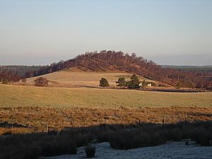
Dunearn from the south west in winter
|
|
| Coordinates | 57°27′02″N 3°47′01″W / 57.4505°N 3.7836°W |
|---|---|
| Type | Hill fort |
| Length | 245 metres (804 ft) |
| Width | 45 metres (148 ft) |
| Height | 266 metres (873 ft) AOD |
| History | |
| Material | Stone, earth |
| Periods | Iron Age, Pictish |
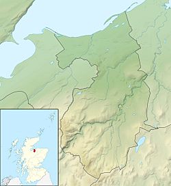
Dunearn is an ancient hill fort located about 15 kilometres (9.3 mi) south of Nairn in the Highland region of Scotland. It sits on a very steep hill called Doune, which rises about 266 metres (873 ft) above sea level. This spot is just south of Dulsie Bridge, a modern bridge over the River Findhorn.
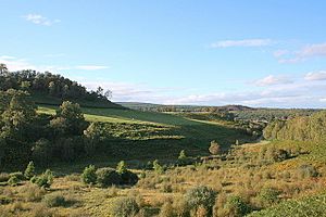
From Dunearn, you can see far and wide across the Findhorn valley. This includes views towards the pass of Streens in the west. This pass leads to another valley called upper Strath Dearn. The fort's location was perfect for keeping watch over the area.
What's in a Name?
The name Dunearn comes from the Scots Gaelic language. It means "Hill(fort) on the Findhorn." The nearby farm also shares this name.
The name of the River Findhorn itself is interesting. Some experts, like William J. Watson, believe it means "white Ireland." This probably refers to the white sandy beaches at the river's mouth. The Gaelic word Èireann (a form of the word for Ireland) is why we see 'earn' or 'erne' in other local names. Examples include Invererne, Cullerne, and Earnhill.
How the Fort Was Built
The hill leading up to Dunearn is very steep from almost every direction. Only the west side is less steep. The top of the hill is shaped like an 'S'. It was once surrounded by two parallel walls. These walls followed the edge of the flat top of the hill.
The inner wall now looks like scattered stones and boulders. There's also some evidence of vitrification. This means parts of the stone were melted by intense heat, suggesting the fort might have been burned a long time ago. The outer wall is about 20 feet (6.1 m) away from the inner one. It's mostly just a line of stones and boulders.
Because the two walls are so close, it's thought they were built as one strong structure. They might have had wooden supports in the middle. The main entrance to the fort was on the southwest side. The area inside the walls covers about .75 hectares (1.9 acres).
Other Forts Nearby
Dunearn is one of several large, open hill forts in this part of Scotland. Other similar forts include Craig Phadrig and Ord Hill of Kessock. These are both located near modern-day Inverness. Craig Phadrig is thought to have been built around the 4th Century CE.
There are also smaller forts in the area. These include Doune of Relugas and another fort confusingly called Dun Earn. This smaller Dun Earn is about 12 kilometres (7.5 mi) downstream from the main Dunearn. Other forts like Dun Evan and Castle Finlay are in the Nairn valley. In 2017, another large hill fort was confirmed at Cluny Hill in Forres. This one covers a huge area of 3.6 hectares (8.9 acres).
Dunearn Today
For many years, the relatively flat top of Dunearn hill was used for farming. People even ploughed the land until 1906. This farming activity is probably why the stone remains of the fort are not very clear today.
During the Second World War, an artillery base was set up inside the old fort.
 | Frances Mary Albrier |
 | Whitney Young |
 | Muhammad Ali |


