River Findhorn facts for kids
Quick facts for kids River Findhorn |
|
|---|---|
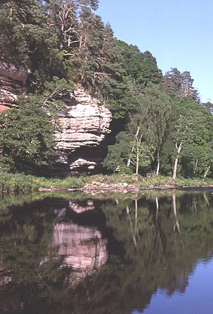
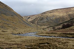
Sandstone cliffs at Sluie
|
|
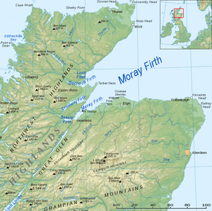
Topographic map of northern Scotland with the River Findhorn at centre
|
|
| Native name | Uisge Fionn Èireann |
| Country | Scotland |
| Physical characteristics | |
| Main source | 500 metres 57°10′51″N 4°13′51″W / 57.18083°N 4.23083°W |
| River mouth | Sea level 57°39′38″N 3°37′38″W / 57.66056°N 3.62722°W |
| Length | 100 kilometres (62 mi) |
| Basin features | |
| Landmarks | Dunearn, Randolph's Leap, Sueno's Stone, Forres |
| Tributaries |
|
The River Findhorn (in Scottish Gaelic: Uisge Fionn Èireann) is one of Scotland's longest rivers. It flows through the northeast of the country. The river ends its journey by flowing into the Moray Firth on the north coast. It has one of the largest estuaries (where a river meets the sea) in Scotland that isn't a firth (a long, narrow inlet of the sea).
The River Findhorn is about 100 kilometres (62 mi) (62 miles) long. Its catchment area, which is the land where all the water drains into the river, covers about 1,300 square kilometres (500 sq mi) (500 square miles).
This river is famous for fishing, especially for salmon and trout. People who enjoy fishing come from all over to visit. It is also a popular spot for white water kayaking and canoeing. The river has different levels of difficulty for kayakers, from easy (grade 2) to challenging (grade 4).
Contents
Journey of the River Findhorn
The River Findhorn starts high up in the Monadhliath Mountains in the Coignafearn Forest. Several small streams join together to form the main river. One of these is the River Eskin, and another is the Abhainn Cro-chlach. They meet around 500 metres (1,600 ft) (1,640 feet) above sea level. From there, the river flows through a valley called Strath Dearn.
In its upper parts, the river winds a lot. It flows through a valley that hasn't been changed much by glaciers. As it continues, other streams like the Elrick Burn and Glenmazaran Burn add to its flow. The first town of any size along the river is Tomatin. Here, the river passes under a railway line and a main road (the A9).
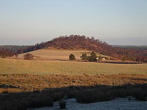
Further downstream, the river enters a narrow, rocky section called the Streens gorge. This part is about 7 kilometres (4.3 mi) (4.3 miles) long and is mostly wild and uninhabited. After the gorge, the valley becomes more wooded again. The river then turns north, flowing through another narrow gorge near Dulsie Bridge. Here, you can see the ancient hillfort of Dunearn.
The River Findhorn then meets the River Divie at a beautiful spot called Randolph's Leap. This area is known for exciting kayaking. The river continues past Logie House and the Altyre estate.
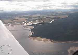
Finally, the river reaches the town of Forres, which is the largest settlement on its route. After passing under a bridge and a railway line, the river flows into Findhorn Bay. This is a large area where the river meets the sea. At low tide, the river flows freely over the sands, joined by other small streams. The combined waters then flow out of the bay through a narrow channel and into the Moray Firth.
What Does the Name Findhorn Mean?
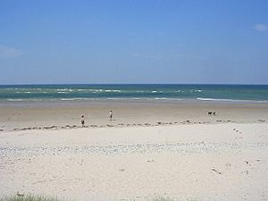
The exact meaning of the name 'Findhorn' isn't fully clear. One idea is that it comes from the Scottish Gaelic words Fionn Èire, which means "white Ireland." This name might refer to the white sands found in the river's estuary. The Gaelic word Èireann (meaning "of Ireland") is also seen in other local names like Invererne and Dunearn.
Many small streams that flow into the Findhorn are called "burns." This is a Scots word for a stream. Other common Gaelic words for streams or rivers you might hear are abhainn and allt.
Some other place names along the river also have Gaelic meanings:
- Monadhliath means "grey mountain range."
- Càrn means a pile of stones or a cairn.
- Coignafearn means "the fifth of the alder," referring to a old land measurement.
- Tomatin means "juniper hillock."
- Forres comes from farrais, meaning a small group of trees.
- Kinloss comes from cinn lois, meaning "herb headland."
How the Land Was Formed
Millions of years ago, around 500 million years ago (mya), the land that is now northern Scotland was pushed up and folded. This process, called the Caledonian orogeny, helped create the Grampian Mountains, which include the Monadhliaths where the Findhorn begins.
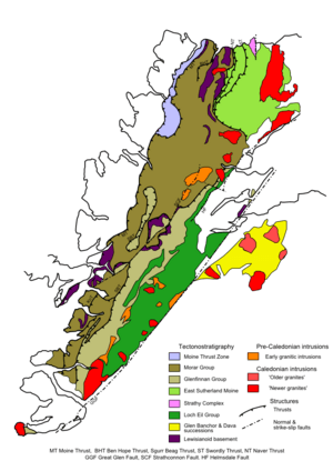
The rocks in the upper part of the Findhorn valley are mostly from the Moine Supergroup. These rocks are very old, about 750 mya, and are made of changed sandstone, rich in quartz, mixed with some shale and mudstone.
Further down the river, the rocks are Old Red Sandstone. These were formed after the mountains were uplifted. Rivers quickly eroded the mountains, spreading sediment into the Moray Firth basin. This happened about 360–400 mya, when Scotland was much closer to the equator and had a dry climate.
Around 65–50 mya, volcanic activity on Scotland's west coast caused the land to tilt. This created the eastward slope that the River Findhorn follows today.
During the Ice Age, about 2 million years ago, all of northern Scotland was covered in thick ice. When this ice melted quickly, it released huge amounts of water. This meltwater carved out features like river terraces and left behind piles of rock and dirt called moraines.
The weight of the ice pushed the land down. As the ice melted, the land slowly rose back up. This, along with rising sea levels, created a changing coastline. For example, there's a raised ancient shoreline between Nairn and Forres, near the Culbin Forest.
Even in more recent times, the coastline has changed. Old maps from 1590 show a long sand bar near the village of Findhorn. Over time, this sand bar was broken by the sea, and wind-blown sands caused the river channel in Findhorn Bay to become shallower. Because of this erosion, the people of Findhorn village moved to a new location about 1.6 kilometres (0.99 mi) (1 mile) southeast, where the village stands today.
Ancient Settlements Along the River
Several ancient Iron Age hillforts can be found along the River Findhorn. These include Dunearn (near Dulsie Bridge), Doune of Relugas, Dun Earn (by Conicavel), and Cluny Hill in Forres. These forts were likely used for defense and as important community centers long ago.
Rodney's Stone is a Pictish cross slab, a type of carved stone, found near Brodie Castle. It was discovered in 1781.
The River in Medieval Times
Sueno's Stone is a very large Picto-Scottish standing stone located on the edge of Forres. It is over 6.5 metres (21 ft) (21 feet) tall and is the biggest surviving Pictish stone of its kind.
Forres Castle once stood on the bank of the Mosset Burn. It might have been where King Dub was killed in 966. Forres became a Royal Burgh (a type of town with special rights) a long time ago. Kinloss Abbey, a monastery, was founded in 1150. Today, only ruins remain.
In 1303, Edward I of England stayed at Lochindorb Castle during his military control of Scotland. This castle, built by the Comyns family, was on an island in the loch. A famous person linked to the Findhorn valley was Alexander Stewart, known as the "Wolf of Badenoch." He was based at the castle and famously burned Forres and other places in 1390. The castle was later destroyed in 1455.
The River in Modern Times
There are stories that the last wolf in Scotland was killed in the Findhorn valley in 1743 by a deer stalker named MacQueen.
During the Jacobite rebellion in 1745, a French ship called Le Bien Trouvé managed to sneak into Findhorn Bay in March 1746. The bay was too shallow for British warships. On April 6, the French ship escaped safely, carrying an important aide to Bonnie Prince Charlie.
The Findhorn valley was greatly affected by the Highland Clearances. This was a sad time when many people were forced to leave their homes in the Highlands.
The Muckle Spate of 1829 was a huge natural disaster for the Findhorn. On August 3, 1829, heavy rain caused massive floods in several rivers in northeast Scotland. The flooding on the Findhorn was one of the worst in modern UK history. Eyewitness accounts describe daring rescues of people trapped by the floods. At Randolph's Leap, the river reached incredible heights. It's said that a butler at nearby Relugas caught a salmon 50 feet (15 m) (15 meters) above the normal river level with his umbrella!
Between 1919 and 1963, the Forestry Commission planted many trees on the Culbin sands, creating the large conifer forest you see today. More recently, Moray Council worked on a flood prevention plan for the Mosset Burn to protect the town of Forres from future floods.
Important Buildings Along the Findhorn
The Findhorn valley has many interesting and historic buildings. Some of these are large houses on Highland estates. These include:
- Dunphail House, on the River Divie, built where a 14th-century castle once stood.
- Logie House, near Randolph's Leap, known for its white walls and stepped gables.
- Darnaway Castle, which has a unique 15th-century hall called Earl Randolph's Hall.
- Altyre, with its 19th-century Italian-style farm buildings, now used by the Glasgow School of Art.
- Brodie Castle, which has large formal gardens and was visited by the famous poet Robert Burns in 1787.
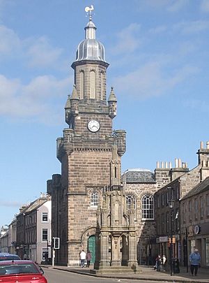
In Forres, the Tolbooth on the High Street is an important building. It was designed in 1838 and has a tall tower with a dome. Cluny Hill College, built in 1863, was once a health spa. Nelson's Tower, an octagonal building on the nearby Cluny Hills, is a well-known landmark. It was built in 1806 to celebrate Lord Nelson's victory at the Battle of Trafalgar.
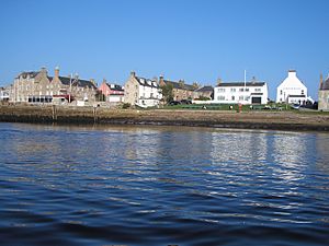
At Findhorn Ecovillage, the Universal Hall is an arts and conference center. In the village of Findhorn itself, you can find the Crown and Anchor Inn, built in 1739, and Findhorn House, home to the Royal Findhorn Yacht Club.
Nature and Fun Activities
The land along the River Findhorn is used for farming and growing trees. But many people also enjoy outdoor activities here. In the high moorlands where the river starts, hunting red deer and grouse is common. Hiking and bird watching are also popular for tourists.
In these areas, tough plants like heather and juniper grow well in the peaty soil. In the sheltered parts of the valley, you can find groups of Scots pine trees.
See also
 In Spanish: Río Findhorn para niños
 | Selma Burke |
 | Pauline Powell Burns |
 | Frederick J. Brown |
 | Robert Blackburn |


