Dupont, Ohio facts for kids
Quick facts for kids
Dupont, Ohio
|
|
|---|---|
|
Village
|
|

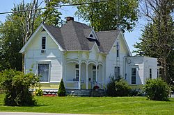
Stick-Eastlake cottage on River Street
|
|

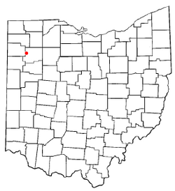
Location of Dupont, Ohio
|
|

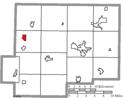
Location of Dupont in Putnam County
|
|
| Country | United States |
| State | Ohio |
| County | Putnam |
| Area | |
| • Total | 0.92 sq mi (2.37 km2) |
| • Land | 0.91 sq mi (2.36 km2) |
| • Water | 0.00 sq mi (0.01 km2) |
| Elevation | 725 ft (221 m) |
| Population
(2020)
|
|
| • Total | 212 |
| • Estimate
(2023)
|
206 |
| • Density | 232.20/sq mi (89.65/km2) |
| Time zone | UTC-5 (Eastern (EST)) |
| • Summer (DST) | UTC-4 (EDT) |
| ZIP code |
45837
|
| Area code(s) | 419 |
| FIPS code | 39-22974 |
| GNIS feature ID | 2398760 |
Dupont is a small village located in Putnam County, Ohio, in the United States. In 2020, about 212 people lived there.
Contents
History of Dupont
Dupont was officially planned and marked out in 1877. This happened when a railway line, the Toledo, Delphos, and Indianapolis Railway, was built to reach that spot.
The village got its name from Samuel Francis Du Pont. He was a famous admiral in the United States Navy who served during the Mexican War. Dupont became an official village in 1888.
Geography of Dupont
Dupont is located in Ohio. According to the United States Census Bureau, the village covers a total area of about 0.93 square miles (2.37 square kilometers). Almost all of this area is land.
People of Dupont
The number of people living in Dupont has changed over the years. Here's a quick look at its population:
| Historical population | |||
|---|---|---|---|
| Census | Pop. | %± | |
| 1880 | 165 | — | |
| 1890 | 531 | 221.8% | |
| 1900 | 370 | −30.3% | |
| 1910 | 334 | −9.7% | |
| 1920 | 270 | −19.2% | |
| 1930 | 206 | −23.7% | |
| 1940 | 217 | 5.3% | |
| 1950 | 225 | 3.7% | |
| 1960 | 239 | 6.2% | |
| 1970 | 302 | 26.4% | |
| 1980 | 308 | 2.0% | |
| 1990 | 279 | −9.4% | |
| 2000 | 268 | −3.9% | |
| 2010 | 318 | 18.7% | |
| 2020 | 212 | −33.3% | |
| 2023 (est.) | 206 | −35.2% | |
| U.S. Decennial Census | |||
Population in 2010
In 2010, there were 318 people living in Dupont. These people made up 134 households, and 86 of those were families. The village had about 342 people per square mile.
Most of the people living in Dupont were White (99.4%). A small number (0.6%) were Native American. About 0.9% of the population identified as Hispanic or Latino.
Households and Families
Out of the 134 households in 2010:
- About 25% had children under 18 living with them.
- About 43% were married couples living together.
- About 13% had a female head of the house with no husband present.
- About 7.5% had a male head of the house with no wife present.
- About 36% were not families (meaning individuals living alone or with non-relatives).
The average household had 2.37 people, and the average family had 2.92 people.
Age Distribution
The average age of people in Dupont in 2010 was 39.6 years old.
- About 18.6% of residents were under 18 years old.
- About 8.1% were between 18 and 24 years old.
- About 32.1% were between 25 and 44 years old.
- About 31.4% were between 45 and 64 years old.
- About 9.7% were 65 years old or older.
The village had slightly more males (51.9%) than females (48.1%).
See also
 In Spanish: Dupont (Ohio) para niños
 | James Van Der Zee |
 | Alma Thomas |
 | Ellis Wilson |
 | Margaret Taylor-Burroughs |

