Duque de Caxias, Rio de Janeiro facts for kids
Quick facts for kids
Duque de Caxias
|
|||
|---|---|---|---|
|
Municipality
|
|||
| Município de Duque de Caxias Municipality of Duque de Caxias |
|||
|
From top, left to right: skyline of Duque de Caxias; Church of Our Lady of the Pillar; pedestrian zone in downtown Duque de Caxias; house and chapel of the historic São Bento Farm
|
|||
|
|||
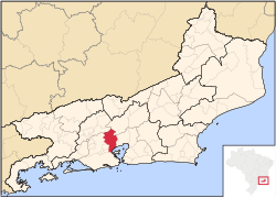
Location of Duque de Caxias in the State of Rio de Janeiro
|
|||
| Country | |||
| Region | Southeast | ||
| State | |||
| Founded | 31 December 1943 | ||
| Area | |||
| • Total | 464.573 km2 (179.373 sq mi) | ||
| Elevation | 7 m (23 ft) | ||
| Population
(2020)
|
|||
| • Total | 924,624 | ||
| • Rank | 18th | ||
| • Density | 1,860.61/km2 (4,818.23/sq mi) | ||
| Demonym(s) | Caxiense | ||
| Time zone | UTC−3 (BRT) | ||
| Postal Code |
25000-000
|
||
| Area code(s) | +55 21 | ||
| Website | Duque de Caxias, Rio de Janeiro | ||
Duque de Caxias is a big city in southeastern Brazil. It's located on Guanabara Bay and is part of the larger Rio de Janeiro area.
This city is right next to Rio de Janeiro city to the south. In 2020, about 924,624 people lived here. It covers an area of 465 square kilometers. This makes it the second most populated suburb of Rio de Janeiro city. It's also the third most populated city in the whole Rio de Janeiro state. The current mayor is Washington Reis.
The city is named after Luís Alves de Lima e Silva, Duke of Caxias. He was a very important Brazilian leader born here in 1803. Duque de Caxias is known for its chemical and oil refining industries.
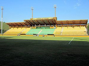
The local football (soccer) team is Duque de Caxias Futebol Clube. They play their games at Estádio Romário de Souza Faria. Another team, Esporte Clube Tigres do Brasil, plays at Estádio De Los Larios in the Xerém area.
Contents
A Look at History
Early Days and Growth
People started settling in this area way back in the 1500s. This was when the Captaincy of São Vicente was created. Important figures like Brás Cubas and Cristóvão Monteiro received land here. At first, the main activity was growing sugarcane. Corn, beans, and rice were also important crops.
In the 1600s and 1700s, the area was divided based on church regions. Places like Pilar and Meriti, which are now part of Duque de Caxias, belonged to Iguaçu. This region became a key stop for valuable goods. Gold from Minas Gerais and coffee from the Paraíba Valley passed through here. Coffee made up about 70% of Brazil's economy back then!
Since there weren't many good roads, most goods traveled by river. The area had many rivers and was close to Guanabara Bay. This made it a perfect spot for paths leading inland. The Port of Estrela was a very important place during this time. A town grew around it, which later became Vila da Estrela.
Challenges and Changes
After the gold mining slowed down, the region remained a resting place. It was used for travelers and moving goods. The area grew a lot until the 1800s. However, too much deforestation (cutting down trees) caused rivers to get blocked and overflow. This led to swampy areas. The still, polluted water brought many disease-carrying mosquitoes.
The area became almost impossible to live in. Many people left, and properties were abandoned. In the 1850s, diseases spread, forcing landowners to move. Duque de Caxias stayed in a difficult state for many decades.
Things got even worse when trains arrived. The D. Pedro II Railway connected the capital to other towns. Goods from the Paraíba Valley started using the railway. Rivers and old land routes were no longer used. The river ports lost their importance, and the region declined sharply.
When slavery was abolished in 1888, more changes happened. Sanitation work was stopped, and health conditions got worse. Diseases like Malaria became common.
Modern Times and Becoming a City
In the early 1900s, some improvements began. Piped water arrived in 1916. But the biggest change came in the 1930s with the Sanitation Commission. By 1945, over 6,000 kilometers of rivers were cleaned. This greatly reduced diseases.
The railroad also helped the region connect to Rio de Janeiro. New train stations opened in 1911. This led to more people moving to neighborhoods like Gramacho and Saracuruna.
Even with the railway, the area still needed better sanitation. In the early 1900s, many people from Rio de Janeiro moved to the lowlands. The population grew quickly. In 1924, the first electricity grid was installed. The opening of the Rio-Petrópolis Highway in 1928 brought more growth. Many companies bought land and settled here because it was close to Rio de Janeiro.
A group of local people, including journalists and doctors, worked to make Duque de Caxias its own city. In 1940, they formed a commission to push for this. On December 31, 1943, Duque de Caxias officially became a municipality. This brought a big boost to its economy. Many people, especially from Brazil's Northeast, moved here for work. The city government officially started on January 1, 1944.
Where is Duque de Caxias?
Duque de Caxias is bordered by several other places. To the north are Petrópolis and Miguel Pereira. To the east are Guanabara Bay and Magé. To the south is the city of Rio de Janeiro. To the west are São João do Meriti, Belford Roxo, and Nova Iguaçu.
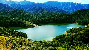
The city generally has a hot climate. However, the 3rd and 4th districts (Imbariê and Xerém) are a bit cooler. This is because they have more green areas and are closer to the Serra dos Órgãos mountains.
The municipality is home to part of the Tinguá Biological Reserve. This is a large protected area of Atlantic Forest. It also has the Taquara Municipal Nature Park, which is popular for visitors.
Several rivers flow through the area. The Meriti River separates Duque de Caxias from Rio de Janeiro city. The Rio Iguaçu separates it from Nova Iguaçu. The Rio Sarapuí divides the 1st and 2nd districts, and the Saracuruna River divides the 2nd and 3rd districts.
Population Growth
| Year | Population |
|---|---|
| 1960 | 785 041 |
| 1980 | 776 230 |
| 1995 | 770 669 |
| 2010 | 855 046 |
| 2012 | 858 334 |
| 2013 | 873 921 |
The population of Duque de Caxias was 873,921 in 2013. This was an increase from 785,041 in 1960. The city has seen steady growth since it was founded. In 2010, about 29.5% of the population was white. About 58.8% were brown (mixed races), and 11.5% were black.
What's the Economy Like?
Duque de Caxias has a strong and growing economy. Its main activities are industry and trade. There are around 809 industries and 10,000 shops in the city.
In 2005, Duque de Caxias had the 15th largest economy (GDP) in Brazil. It was the second largest in the state of Rio de Janeiro. The city also ranks second in the state for tax revenue.
One of the biggest oil refineries for Petrobras is located here. The city also has a large gas and chemical industrial area. Key industries include chemicals, oil, metalwork, plastics, furniture, and textiles.
Many companies have chosen to set up in Duque de Caxias. This is because of its great location near major highways. It's also close to Tom Jobim International Airport. The city is only about 17 km from downtown Rio. This makes it easy to transport products to big cities like São Paulo and Minas Gerais.
Duque de Caxias has the largest industrial park in Rio de Janeiro. Big companies like Texaco, Shell, and Carrefour are here. The chemical and petrochemical industries are especially strong. This is due to the presence of REDUC, the second largest refinery in Brazil.
The city center has a busy popular trade area. Most of the shops are on José Alvarenga and Nilo Peçanha streets.
Getting Around
Duque de Caxias has many ways to get around. There are 16 public transport companies serving the city. This includes 11 local bus companies. The city also has a railway branch and three intercity rail lines.
There are two federal highways and four state roads. The railway line from Central Station of Brazil goes through the city. It connects to other lines, reaching places like Magé.
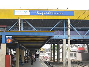
In total, there are eleven train stations in Duque de Caxias. These include Duque de Caxias, Gramacho, and Saracuruna.
Main Roads
- President Kennedy Avenue
- Rio-Teresópolis
- Red Line
- BR-040
Learning and Fun
Duque de Caxias has many schools and places for learning. There are 100 city schools, 2 federal schools, 102 state schools, and 128 private schools. About 92.40% of people aged 10 or older can read and write.
The city also has several higher education institutions:
- The Federal University of Rio de Janeiro has a campus in Xerém. It offers programs in nanotechnology and biotechnology.
- The Faculty of Education of Baixada Fluminense is a state institution. It's part of the State University of Rio de Janeiro. It offers courses in education, math, and geography.
- The Educational Foundation of Duque de Caxias (FEUDUC) started in 1969. It offers courses in biology, history, and math.
- UNIGRANRIO is a large and well-known university. It started in the 1970s and became a university in 1994. Its main campus is in the Jardim 25 de Agosto district.
- The University of Sa Estácio also has a campus here. It offers courses in administration, law, and computer science.
- There's also the School of Social Service Santa Luzia.
Duque de Caxias is home to some excellent schools. These include Cefet-chemical (Cefeteq – Caxias) and the traditional Pedro II College.
Culture and Heritage
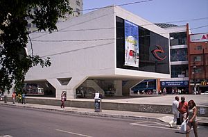
The city has the Centro Cultural Oscar Niemeyer. This cultural center includes the Public Library Leonel de Moura Brizola. The library has about 10,000 books. There's also the Teatro Municipal Raul Cortez, a theater with 440 seats.
Duque de Caxias also has the Historical Institute and Theater Procópio Ferreira. This institute has a collection of photos, documents, and old newspapers. It shows the city's history, like the arrival of piped water.
Historic Places to See
- Our Lady of Pilar Church – This church was built in 1720. It has beautiful baroque features, similar to churches in Minas Gerais. It was an important stop for D. Pedro I, a former emperor of Brazil. The church was officially recognized as a historic site in 1938.
- Fazenda São Bento – This is the oldest farm in the municipality. It was bought by the Monastery of St. Benedict in 1591. This started the settlement of the Vale do Rio Iguaçu. Today, only the ruins of the chapel (from 1645) and the main house (from 1754-1757) remain. It became a historic heritage site in 1957.
Sports and Fun!
Duque de Caxias is home to two football (soccer) clubs.
- Duque de Caxias Futebol Clube
- Esporte Clube Tigres do Brasil
Both teams have played in the top state championship.
The city has two football stadiums:
- The Estádio Romário de Souza Faria is for Duque de Caxias Futebol Clube. It can hold 10,000 people.
- The Estádio De Los Larios is for Esporte Clube Tigres do Brasil. It can hold 11,000 people.
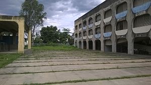
Duque de Caxias also has an Olympic village, which is great for sports training.
Neighborhoods and Areas
Duque de Caxias is divided into four main districts, each with many neighborhoods.
District 1
- Centro (downtown)
- Jardim 25 de agosto
- Centenario
- Engenho do Porto
- Parque Duque
- Parque Lafaiete
- Vila São luiz
- Jardim Leal
- Gramacho
- Sarapui
- Doutor Laureano
- Bar dos Cavalheiros
- Jardim Gramacho
- Olavo Bilac
- Periquitos
- Corte Oito
District 2
- Campos Elyseos
- Pilar
- Cidade dos Meninos
- Jardim Primavera
- Figueira
- Capivari
- Saracuruna
District 3
- Imbarie
- Nova Campina
- Santa Cruz da Serra
- Cangulo
- Chacarás Rio Petropolis
- Chacara arcampo
- Eldourado
- Taquara
- Parque Paulista
- Parque Equitativa
- Alto da Serra
- Santa Lucia
- Jardim Anhanga
- Parada Morabi
District 4
- Xerém
- Mantiqueira
- Parque Capivari
- Jardim Olimpo
- Lamarão
- Amapá
- Vila Canaã
Famous People from Here
Many talented people come from Duque de Caxias!
- Alex Teixeira - footballer
- Bruna Marquezine – actress
- Júlio César Soares Espíndola – footballer
- Roberto Dinamite – ex-footballer
- Ludmilla (singer) – singer
- Zeca Pagodinho – singer
- Davidson da Luz Pereira - footballer
See also
In Spanish: Duque de Caxias para niños
 | Ernest Everett Just |
 | Mary Jackson |
 | Emmett Chappelle |
 | Marie Maynard Daly |


