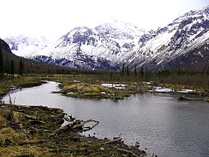
Eagle River (Cook Inlet) facts for kids
Quick facts for kids Eagle River |
|
|---|---|

Eagle River in winter.(Chugach State Park)
|
|
|
Location of where Eagle River (Alaska) feeds into the Cook Inlet.
|
|
| Country | United States |
| State | Alaska |
| Municipality | Municipality of Anchorage |
| Physical characteristics | |
| Main source | Eagle Glacier Chugach Mountains, Alaska 958 ft (292 m) 61°07′43″N 149°03′57″W / 61.12861°N 149.06583°W |
| River mouth | Eagle Bay, Knik Arm, Cook Inlet 9 miles (14 km) northeast of downtown Anchorage, Within Joint Base Elmendorf-Richardson 0 ft (0 m) 61°19′43″N 149°44′19″W / 61.32861°N 149.73861°W |
| Length | 40 mi (64 km) |
| Basin features | |
| Basin size | 192 sq mi (500 km2) |
The Eagle River is a beautiful river in Alaska, near the city of Anchorage. It's about 40 miles (64 km) long. This river starts high up at the Eagle Glacier in Chugach State Park. It then flows northwest and empties into Eagle Bay, which is part of the Knik Arm of Cook Inlet. This spot is about 9 miles (14 km) northeast of downtown Anchorage.
River's Journey: Where Eagle River Flows
The Eagle River begins its journey at the Eagle Glacier, located within Chugach State Park. Soon after starting, the river crosses paths with the famous Iditarod National Historic Trail. This historic trail follows the Eagle River Valley. It stretches from near Crow Pass in Chugach National Forest all the way to the community of Eagle River.
Further downstream, the river flows past the Eagle River Nature Center. This center is a visitor spot for the park. It sits along the North Fork Eagle River, which flows mostly parallel to the main river for several miles. Eagle River Road also runs alongside the North Fork, to the right side of the main river if you're looking downstream. This road connects the visitor center to the Eagle River community, which is about 12 miles (19 km) away.
After the North Fork joins the main Eagle River, the South Fork Eagle River also flows in from the left side. The river then passes under Eagle River Loop Road. In its lower parts, the river flows by the Eagle River community, which is on the right, and the Eagle River Campground, on the left. After this, the river leaves the state park. It then goes under the Glenn Highway and flows through Joint Base Elmendorf-Richardson, which is a military area. Finally, it reaches Eagle Bay on Cook Inlet.
Boating Adventures on Eagle River
Many parts of the Eagle River are great for floating in different kinds of boats. These sections are rated from Class I (easy) to Class III (difficult) on the International Scale of River Difficulty. Getting your boat into the main river west of the visitor center can be a tough portage (carrying your boat over land).
A much easier place to start your boating trip is along the North Fork. This spot is near Eagle River Road, not far from where the North Fork joins the main river. Be aware of some dangers on the river. There are Class II (medium) and Class III rapids near Eagle River Campground. Also, watch out for plants hanging over the water, plants hidden under the surface, and piles of logs that can block your way.
Eagle River Nature Center: Explore and Learn
The Eagle River Nature Center is a special place located about 12 miles (19 km) up Eagle River Road. It serves as an entrance to Chugach State Park. The center, along with its "friends" group, offers many educational programs. These programs help people connect with nature through learning and outdoor trips.
The historic Crow Pass Trail is a popular backpacking route. It stretches about 26 miles (42 km) from the Eagle River Nature Center. The trail ends near the town of Girdwood. It's a favorite adventure for many hikers.
 | Janet Taylor Pickett |
 | Synthia Saint James |
 | Howardena Pindell |
 | Faith Ringgold |


