Early, Iowa facts for kids
Quick facts for kids
Early, Iowa
|
|
|---|---|
 |
|
| Motto(s):
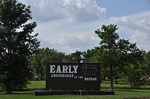
"Crossroads Of The Nation"
|
|

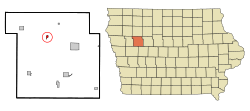
Location of Early, Iowa
|
|
| Country | |
| State | |
| County | Sac |
| Township | Boyer Valley |
| Area | |
| • Total | 0.39 sq mi (1.01 km2) |
| • Land | 0.39 sq mi (1.01 km2) |
| • Water | 0.00 sq mi (0.00 km2) |
| Elevation | 1,345 ft (410 m) |
| Population
(2020)
|
|
| • Total | 587 |
| • Density | 1,509.00/sq mi (582.26/km2) |
| Time zone | UTC-6 (Central (CST)) |
| • Summer (DST) | UTC-5 (CDT) |
| ZIP code |
50535
|
| Area code(s) | 712 |
| FIPS code | 19-23475 |
| GNIS feature ID | 0456107 |
| Website | City of Early, Iowa |
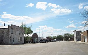
Early is a small city located in Sac County, Iowa, in the United States. It's known as the "Crossroads Of The Nation" because two major highways meet there. In 2020, about 587 people lived in Early.
Contents
History of Early
Early became an official city on May 22, 1883. It was named after D.C. Early, who was one of the first people to settle in the area.
Geography of Early
Early is located in Iowa at specific coordinates: 42.461903 degrees North and 95.151290 degrees West.
The city covers a total area of about 0.39 square miles (1.01 square kilometers). All of this area is land, meaning there are no large lakes or rivers within the city limits.
Population and People
Early is famous for being the "Crossroads of the Nation." This is because U.S. Highway 71 and U.S. Route 20, two important roads, cross paths right here.
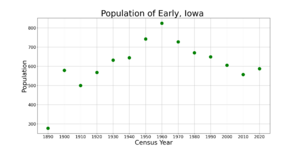
| Historical populations | ||
|---|---|---|
| Year | Pop. | ±% |
| 1890 | 277 | — |
| 1900 | 579 | +109.0% |
| 1910 | 500 | −13.6% |
| 1920 | 568 | +13.6% |
| 1930 | 632 | +11.3% |
| 1940 | 644 | +1.9% |
| 1950 | 742 | +15.2% |
| 1960 | 824 | +11.1% |
| 1970 | 727 | −11.8% |
| 1980 | 670 | −7.8% |
| 1990 | 649 | −3.1% |
| 2000 | 605 | −6.8% |
| 2010 | 557 | −7.9% |
| 2020 | 587 | +5.4% |
| Source: and Iowa Data Center Source: |
||
Early's Population in 2020
According to the census taken in 2020, there were 587 people living in Early. These people lived in 247 households, and 157 of these were families.
The city had about 1,508 people per square mile. Most residents were White (89.4%). About 4.4% of the population identified as Hispanic or Latino.
The average age of people in Early was 36.9 years old.
- About 25.9% of residents were under 20 years old.
- About 15.5% were 65 years old or older.
The population was almost evenly split between males (50.1%) and females (49.9%).
Early's Population in 2010
In the 2010 census, Early had 557 people. There were 246 households and 146 families.
The population density was about 1,428 people per square mile. Most people were White (93.2%). About 4.5% of the population was Hispanic or Latino.
The average age in 2010 was 40.9 years.
- About 25.5% of residents were under 18.
- About 16.5% were 65 or older.
The city had slightly more females (50.6%) than males (49.4%).
Education in Early
Students in Early attend schools within the Schaller-Crestland Community School District. This district was created in 1993 when two smaller districts, Schaller and Crestland, joined together. The school teams are called the Wildcats, and their colors are black, white, and gold.
Before this, the Early Community School District was known as the Cardinals, with red and black colors. In 1958, Early's school merged with Nemaha's school to form the Crestland Community School District. Their new nickname was the Cadets, and their colors were black and white.
In 2010, the Schaller-Crestland district started sharing grades with the Galva-Holstein School District.
- Elementary students still go to separate schools in Schaller, Galva, and Holstein.
- Middle school students (grades 6-8) from Galva and Schaller now go to the Early high school building.
- High school students (grades 9-12) go to Holstein's High School.
The combined high school mascot is now the Raptors, and their school colors are black, gold, and orange.
A Song About Early
The city of Early is featured in a song simply titled "Early." It was written by the folk musician Greg Brown. You can find this song on his album 44 & 66, which was released in 1980.
See also
 In Spanish: Early (Iowa) para niños
 | Kyle Baker |
 | Joseph Yoakum |
 | Laura Wheeler Waring |
 | Henry Ossawa Tanner |


