East End (Arizona) facts for kids
Quick facts for kids East End |
|
|---|---|
| Highest point | |
| Elevation | 4,069 ft (1,240 m) NAVD 88 |
| Prominence | 1,347 ft (411 m) |
| Geography | |
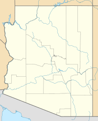
| Location | Maricopa County, Arizona, U.S. |
| Parent range | McDowell Mountains |
| Topo map | USGS McDowell Peak |
East End is a mountain located in Arizona, United States. It is part of the McDowell Mountains and is the highest point in that mountain range. This mountain is known for its rocky slopes and an ancient event called the Marcus Landslide.
Contents
What is East End Mountain?
East End is a prominent mountain in the McDowell Mountains range. It stands out because its top, called the summit, is the highest point in the entire range. The mountain's surface is mostly covered with large rocks and boulders.
Where is East End Located?
East End mountain is found in Maricopa County, Arizona, which is in the state of Arizona. It is located at the northeastern end of the McDowell Mountains. If you were in Scottsdale, Arizona, East End would be about 24 miles (39 km) to the north-northeast.
How Tall is East End?
The summit of East End mountain reaches an elevation of 4,069 feet (1,240 meters) above sea level. This makes it the tallest peak in the McDowell Mountains. Its height offers great views of the surrounding desert landscape.
What is the Marcus Landslide?
East End is also famous for being the site of the ancient Marcus Landslide. A landslide happens when a large amount of rock, earth, or debris moves down a slope. The Marcus Landslide was a very big event that shaped part of the mountain long ago. Scientists study this area to learn more about how the Earth's surface changes over time.
Exploring the McDowell Mountains
The McDowell Mountains are a mountain range located northeast of Phoenix, Arizona. They are a popular spot for outdoor activities like hiking and mountain biking. The mountains are part of the Sonoran Desert and are home to many types of desert plants and animals. East End is a key part of this natural area.
 | Stephanie Wilson |
 | Charles Bolden |
 | Ronald McNair |
 | Frederick D. Gregory |


