East Fork Salmon River facts for kids
Quick facts for kids East Fork Salmon River |
|
|---|---|
|
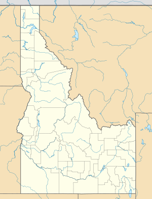
Location of the mouth of the East Fork Salmon River in Idaho
|
|
| Country | United States |
| State | Idaho |
| Region | Custer County |
| Physical characteristics | |
| Main source | Boulder Mountains 43°44′46″N 114°33′17″W / 43.74611°N 114.55472°W |
| River mouth | Salmon River 5,390 ft (1,640 m) 44°16′06″N 114°19′36″W / 44.26833°N 114.32667°W |
| Length | 34 mi (55 km) |
| Basin features | |
| Basin size | 541 sq mi (1,400 km2) |
The East Fork Salmon River is a cool river in Idaho, United States. It flows for about 34-mile (55 km), which is like traveling from one end of a big city to another! This river is a branch of the much larger Salmon River.
Where the East Fork Salmon River Flows
This river runs through Custer County. It's a beautiful area in the state of Idaho. The East Fork Salmon River eventually meets the main Salmon River. This meeting point is about 3.7 miles (6.0 km) east of a town called Clayton. It's also about 17 miles (27 km) south-southwest of Challis.
How the River Begins
The East Fork Salmon River doesn't start from just one spot. It's formed when two smaller streams join together. These streams are called the West Fork East Fork Salmon River and the South Fork East Fork Salmon River.
Mountains and Recreation Area
These two streams meet between some really tall mountains. These are the Boulder Mountains and the White Cloud Mountains. This whole area is part of the Sawtooth National Recreation Area. It's a special place known for its amazing natural beauty and outdoor activities.
 | Precious Adams |
 | Lauren Anderson |
 | Janet Collins |


