East Hodge, Louisiana facts for kids
Quick facts for kids
East Hodge, Louisiana
|
|
|---|---|
|
Village
|
|

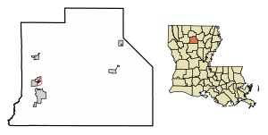
Location of East Hodge in Jackson Parish, Louisiana
|
|

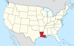
Location of Louisiana in the United States
|
|
| Country | United States |
| State | Louisiana |
| Parish | Jackson |
| Area | |
| • Total | 0.23 sq mi (0.61 km2) |
| • Land | 0.23 sq mi (0.61 km2) |
| • Water | 0.00 sq mi (0.00 km2) |
| Elevation | 203 ft (62 m) |
| Population
(2020)
|
|
| • Total | 204 |
| • Density | 871.79/sq mi (336.46/km2) |
| Time zone | UTC-6 (CST) |
| • Summer (DST) | UTC-5 (CDT) |
| Area code(s) | 318 |
| FIPS code | 22-22465 |
East Hodge is a small village located in Jackson Parish, Louisiana, in the United States. In 2010, about 289 people lived there. This was fewer than the 366 people who lived there in 2000. East Hodge is also part of the larger Ruston area.
Contents
Where is East Hodge Located?
East Hodge is found in the southwestern part of Jackson Parish. It is next to the village of Hodge on its west side. To the northwest is North Hodge.
A main road, U.S. Route 167, runs through Hodge and North Hodge. You can travel north about 5 miles (8 km) to Quitman. Or, you can go south about 3 miles (5 km) to Jonesboro.
The village of East Hodge is on high ground. It is located between two rivers. The Dugdemona River is to the northwest. The Little Dugdemona River is to the south. The total area of East Hodge is about 0.23 square miles (0.6 square kilometers). Only a very small part of this area is water.
How Many People Live in East Hodge?
| Historical population | |||
|---|---|---|---|
| Census | Pop. | %± | |
| 1970 | 363 | — | |
| 1980 | 439 | 20.9% | |
| 1990 | 421 | −4.1% | |
| 2000 | 366 | −13.1% | |
| 2010 | 289 | −21.0% | |
| 2020 | 204 | −29.4% | |
| U.S. Decennial Census | |||
Population Changes Over Time
The number of people living in East Hodge has changed over the years. Here's a quick look at the population counts:
- 1970: 363 people
- 1980: 439 people
- 1990: 421 people
- 2000: 366 people
- 2010: 289 people
- 2020: 204 people
Who Lives in East Hodge?
The U.S. Census collects information about the people living in different places. This helps us understand the community.
In 2020, most people in East Hodge were Black or African American (about 94.6%). A smaller number of people were White (about 2.9%). Some people identified as being of mixed race (about 1.5%). A very small number were Hispanic or Latino (about 1%).
In 2000, there were 135 households in the village. A household is a group of people living together. About 39% of these households had children under 18. The average household had about 2.7 people.
The median age of people in East Hodge in 2000 was 28 years old. This means half the people were younger than 28, and half were older. About 37% of the population was under 18 years old.
The median income for a household in 2000 was $11,786 per year. This is the middle income level for all households. About half of the families in East Hodge were living below the poverty line in 2000. This included many children and older adults.
See also
 In Spanish: East Hodge para niños
 | Toni Morrison |
 | Barack Obama |
 | Martin Luther King Jr. |
 | Ralph Bunche |

