East Springfield, Ohio facts for kids
Quick facts for kids
East Springfield, Ohio
|
|
|---|---|

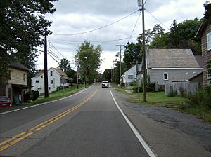
Travelling through East Springfield on Ohio State Route 43
|
|

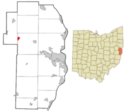
Location of East Springfield in Jefferson County and in the state of Ohio
|
|
| Country | United States |
| State | Ohio |
| County | Jefferson |
| Township | Salem |
| Area | |
| • Total | 0.41 sq mi (1.06 km2) |
| • Land | 0.41 sq mi (1.06 km2) |
| • Water | 0.00 sq mi (0.00 km2) |
| Elevation | 1,240 ft (380 m) |
| Population
(2020)
|
|
| • Total | 185 |
| • Density | 451.22/sq mi (174.05/km2) |
| Time zone | UTC-5 (Eastern (EST)) |
| • Summer (DST) | UTC-4 (EDT) |
| ZIP code |
43925
|
| Area code(s) | 740 |
| FIPS code | 39-24066 |
| GNIS Feature ID | 2628890 |
East Springfield is a small community in Jefferson County, Ohio, United States. It's known as a census-designated place (CDP). This means it's an area that looks like a town but isn't officially set up as a city or village with its own local government.
East Springfield has its own post office and a special code called a ZIP code, which is 43925. The community is located along Ohio State Route 43. It is about 16 miles (26 km) northwest of Steubenville, Ohio, which is the main city of Jefferson County. It's also about 17 miles (27 km) southeast of Carrollton, Ohio.
Contents
What is the History of East Springfield?
East Springfield was first planned out in the year 1803. This means people started to organize the area for building homes and businesses around that time. A post office was opened in East Springfield in 1849. This made it easier for people in the community to send and receive mail.
How Many People Live in East Springfield?
The number of people living in East Springfield is counted every ten years by the United States Census Bureau. This count helps us understand how communities are growing or changing.
Population Count in 2020
According to the 2020 United States Census, there were 185 people living in East Springfield.
What Schools are in East Springfield?
Students in East Springfield attend schools that are part of the Edison Local School District. This school district serves several communities in the area.
Schools Serving the Community
- John Gregg Elementary School: This school is for younger students, from preschool up to Grade 4.
- Springfield Middle School: Students in Grades 5 through 8 attend this school.
- Edison High School: Older students, from Grade 9 to Grade 12, go to Edison High School.
 | Jessica Watkins |
 | Robert Henry Lawrence Jr. |
 | Mae Jemison |
 | Sian Proctor |
 | Guion Bluford |

