East Tawakoni, Texas facts for kids
Quick facts for kids
East Tawakoni, Texas
|
|
|---|---|

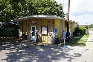
East Tawakoni City Hall and Civic Center
|
|

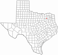
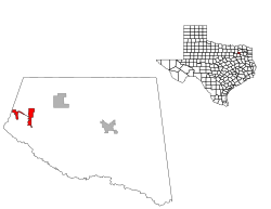
Location of East Tawakoni, Texas
|
|
 |
|
| Country | United States |
| State | Texas |
| County | Rains |
| Area | |
| • Total | 1.83 sq mi (4.75 km2) |
| • Land | 1.78 sq mi (4.62 km2) |
| • Water | 0.05 sq mi (0.13 km2) |
| Elevation | 466 ft (142 m) |
| Population
(2020)
|
|
| • Total | 824 |
| • Density | 450.3/sq mi (173.47/km2) |
| Time zone | UTC-6 (Central (CST)) |
| • Summer (DST) | UTC-5 (CDT) |
| FIPS code | 48-22276 |
| GNIS feature ID | 2410390 |
| Website | http://cityofeasttawakoni.com/ |
East Tawakoni (/təˈwɑːkəni/ TƏ-wah-KƏ-nee) is a small city in Rains County, Texas, United States. In 2020, about 824 people lived there.
East Tawakoni is on the east side of Lake Tawakoni. Its nearby city, West Tawakoni, is on the west side of the lake.
History of East Tawakoni
East Tawakoni was created to be a quiet country community. It was also easy to get to Dallas from there. The city officially started on June 6, 1967. This happened after 30 out of 45 residents voted for it to become a city.
On June 27, 1967, the first leaders were chosen. Grady A. Whitehead became the mayor. Five aldermen were also elected. These were Raymond Briggs, A.L. Williams, D.A. "Doc" Vincent, A.O. Murphrey, and T.E. Bell.
In 1968, residents voted on local rules. This vote changed a long-standing rule in Rains County. Before this, the county had been "dry" for over 60 years.
In 1970, East Tawakoni had 278 people. That same year, a fire destroyed the city hall. All of the city's important papers were lost. City leaders met in a resident's garage until a new building was ready.
The city grew in 1986 when the Blue Heron Cove area joined it. This made East Tawakoni twice as big. By 1990, the city's population had grown to 542 people. It kept growing to 775 people in 2000. This was a big increase from 1990.
Geography and Location
East Tawakoni is found along State Highway 276. It is in the western part of Rains County. The city sits on the eastern shore of Lake Tawakoni. It is about nine miles west of Emory.
The United States Census Bureau says the city covers about 1.9 square miles (4.9 square kilometers). Most of this area is land. A small part, about 0.04 square miles (0.10 square kilometers), is water.
Population Information
| Historical population | |||
|---|---|---|---|
| Census | Pop. | %± | |
| 1970 | 278 | — | |
| 1980 | 404 | 45.3% | |
| 1990 | 642 | 58.9% | |
| 2000 | 775 | 20.7% | |
| 2010 | 883 | 13.9% | |
| 2020 | 824 | −6.7% | |
| U.S. Decennial Census | |||
The table below shows the different groups of people living in East Tawakoni in 2020.
| Race | Number | Percentage |
|---|---|---|
| White (NH) | 700 | 84.95% |
| Black or African American (NH) | 7 | 0.85% |
| Native American or Alaska Native (NH) | 11 | 1.33% |
| Asian (NH) | 15 | 1.82% |
| Some Other Race (NH) | 2 | 0.24% |
| Mixed/Multi-Racial (NH) | 39 | 4.73% |
| Hispanic or Latino | 50 | 6.07% |
| Total | 824 |
In 2020, there were 824 people living in East Tawakoni. There were 305 households and 183 families.
Education
Students in East Tawakoni go to schools in the Rains Independent School District.
See also
 In Spanish: East Tawakoni para niños
 | John T. Biggers |
 | Thomas Blackshear |
 | Mark Bradford |
 | Beverly Buchanan |

