Eaton, Clark County, Wisconsin facts for kids
Quick facts for kids
Eaton, Wisconsin
|
|
|---|---|

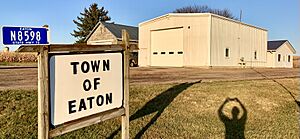
Town hall
|
|

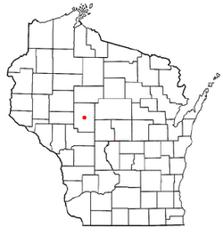
Location of Eaton, Wisconsin
|
|
| Country | |
| State | |
| County | Clark |
| Area | |
| • Total | 33.9 sq mi (87.7 km2) |
| • Land | 33.5 sq mi (86.7 km2) |
| • Water | 0.4 sq mi (1.0 km2) |
| Elevation | 1,086 ft (331 m) |
| Population
(2010)
|
|
| • Total | 712 |
| • Density | 21/sq mi (8.2/km2) |
| Time zone | UTC-6 (Central (CST)) |
| • Summer (DST) | UTC-5 (CDT) |
| Area code(s) | 715 & 534 |
| FIPS code | 55-22250 |
| GNIS feature ID | 1583122 |
| PLSS township | T26N R2W |
Eaton is a small town located in Clark County, in the state of Wisconsin, United States. In 2010, the town had a population of 712 people. It's a quiet place with a rich history, showing how communities grew in Wisconsin.
Contents
Geography of Eaton
The Town of Eaton is right in the middle of Clark County. To its north, you'll find the city of Greenwood. Eaton covers about 87.7 square kilometers (33.9 square miles). Most of this area, about 86.7 square kilometers (33.5 square miles), is land. The rest, about 1.0 square kilometer (0.4 square miles), is water. The Black River flows through the center of the town from north to south.
History of Eaton Township
Early Land Surveys
The area that is now Eaton was first mapped out in June 1847. This was done by a team working for the U.S. government. Later that year, in October and November, another team marked all the important corners of the land sections. They walked through forests and swamps, using tools like chains and compasses to measure everything. Their maps showed a "Waggon Road" (wagon road) east of the Black River. They also noted four cabins along the river, including "Vanduser's cabin" and a mill site near where Greenwood would later be.
First Descriptions of the Land
The early surveyors described the land as gently rolling and good for farming. They noted that the northeast part had some good pine trees. They also found many sugar maple, linden, and elm trees. The Black River was described as a swift, rough, and rocky stream. The surveyors believed the area was perfect for farming and would one day have a large population.
Roads and Early Settlements (1873-1890)
By 1873, a main road connected Neillsville through Eaton and Greenwood. This was a dirt wagon road, similar to today's Highway 73. Greenwood was already on the map, and a post office for lumbermen was located three miles south of Greenwood. More roads were added by 1880, especially east of the Black River. Many settlers built homes along these roads, particularly near Greenwood. A school was built, and even a "hotel" appeared.
By 1890, a stagecoach route ran daily through Eaton. This route connected Neillsville to Withee and followed the dirt road that would become Highway 73.
Growth and Development (1893-1920)
By 1893, about 50 settler homes lined the roads east of the Black River. Maps from this time show several mills, which were important for processing wood. A part of the Wisconsin Central Railroad also reached the south side of Greenwood, helping to transport goods and people. More schools were built as the population grew.
By 1906, even more roads were added, and many more settlers moved to Eaton. A church and more rural schools appeared. A new railroad, the Fairchild and Northeastern, also crossed the northern part of Eaton. While some large areas of land were still unsettled, especially west of the Black River, the town continued to grow.
By 1920, Eaton had its current size and shape. The modern road system was mostly complete, and most of the town was settled. This included areas west of the river. At this time, cheese factories started appearing on maps, showing that the area was changing from mainly logging to farming.
Population and People
Population Overview
In 2000, Eaton had 665 people living in 201 households. Most of the people in Eaton were White (98.50%). A small number of people were from other racial backgrounds.
Household and Family Life
Many households in Eaton were families. About 45.3% of households had children under 18 living with them. Most households (74.1%) were married couples living together. The average household had about 3.31 people, and the average family had about 3.77 people.
Age Distribution
The population in Eaton was spread across different age groups. About 38.6% of the people were under 18 years old. About 10.1% were 65 years or older. The median age in the town was 32 years old. This means half the people were younger than 32, and half were older. There were slightly more males than females in Eaton.
Income Information
In 2000, the average income for a household in Eaton was $37,000 per year. For families, the average income was $42,679 per year.
See also

- In Spanish: Eaton (condado de Clark, Wisconsin) para niños
 | Janet Taylor Pickett |
 | Synthia Saint James |
 | Howardena Pindell |
 | Faith Ringgold |

