Edgerly Island facts for kids

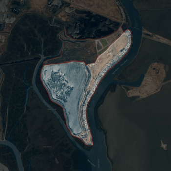
USGS aerial imagery of Edgerly Island. Adjacent land added since the initial survey (to top, darker) is also outlined.
|
|
| Geography | |
|---|---|
| Location | Northern California |
| Coordinates | 38°12′12″N 122°18′52″W / 38.20333°N 122.31444°W |
| Adjacent bodies of water | Napa River |
| Highest elevation | 3 ft (0.9 m) |
| Administration | |
|
United States
|
|
| State | |
| County | Napa |

Edgerly Island is a small island located in the Napa River in Northern California. This river flows into San Pablo Bay, which is part of the larger San Francisco Bay. The island is found in Napa County.
Edgerly Island is managed as part of the Napa-Sonoma Marshes Wildlife Area. This means it's a special place for nature and wildlife. In 1981, the United States Geological Survey measured the island's elevation as about 3 feet (0.91 meters) above sea level. Its exact location is 38°12′12″N 122°18′52″W / 38.20333°N 122.31444°W.
Contents
What is Edgerly Island?
Edgerly Island is a natural landform in the Napa River. It's a low-lying island, meaning it's not very high above the water. Islands like Edgerly are often formed by sediment (like mud and sand) carried by rivers. Over time, this sediment builds up and creates land.
Where is Edgerly Island located?
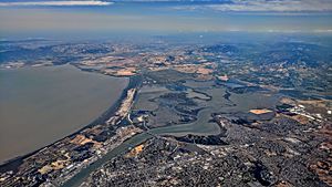
The island is in Napa County, which is north of San Francisco. It's in the lower part of the Napa River, close to where the river meets San Pablo Bay. This area is known for its many islands and marshlands.
Wildlife and Nature
Edgerly Island is part of the Napa-Sonoma Marshes Wildlife Area. This area is very important for many different kinds of animals and plants. It's a protected space where wildlife can thrive.
Why are marshlands important?
Marshlands, like those around Edgerly Island, are special wetlands. They act like natural filters, cleaning the water. They also provide homes for many birds, fish, and other creatures. These areas are vital for the health of the entire San Francisco Bay ecosystem.
- Birds: Many types of birds, including migratory birds, use these marshes for resting and feeding.
- Fish: Young fish often grow up in the calm waters of the marshes before moving to the open bay.
- Plants: Special plants that can live in salty water grow here, providing food and shelter.
History of the Island
Islands in river deltas, like Edgerly Island, can change over time. They are shaped by the flow of the river and the tides. Maps from different years can show how the shape and size of these islands might have changed.
How do maps help us understand islands?
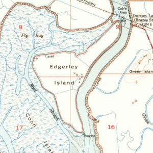
Old maps, like the 1951 USGS map of Edgerly Island, help us see how the land looked in the past. By comparing old maps with new ones, scientists can study how islands and coastlines have changed. This helps them understand natural processes and plan for the future.


