El Manzano facts for kids
Quick facts for kids
El Manzano
|
|
|---|---|

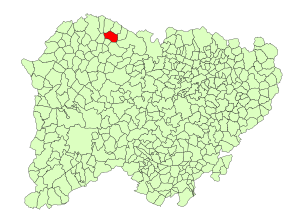
Location in Salamanca
|
|
| Country | Spain |
| Autonomous community | Castile and León |
| Province | Salamanca |
| Comarca | Vitigudino |
| Subcomarca | La Ramajería |
| Area | |
| • Total | 37 km2 (14 sq mi) |
| Elevation | 779 m (2,556 ft) |
| Population
(2018)
|
|
| • Total | 72 |
| • Density | 1.95/km2 (5.04/sq mi) |
| Time zone | UTC+1 (CET) |
| • Summer (DST) | UTC+2 (CEST) |
| Postal code |
37171
|
El Manzano is a small village and municipality in western Spain. It is part of the Salamanca province. This area is located in the Castile and León region.
El Manzano is about 65 kilometres (40 mi) away from Salamanca, which is the main city of the province. In 2018, about 72 people lived in El Manzano.
Geography of El Manzano
This small municipality covers an area of about 37 km2 (14 sq mi). That's roughly the size of 3,700 football fields!
The village sits 779 metres (2,556 ft) above sea level. This means it is quite high up, compared to places near the ocean.
The postal code for El Manzano is 37171. This code helps mail get to the right place.
Government and Leadership
El Manzano is a municipality, which means it has its own local government. The person in charge of the village is called the Mayor.
The current Mayor of El Manzano is María del Carmen Ruano Delgado. She is a member of the PSOE political party. The Mayor helps make decisions for the community.
See also
In Spanish: El Manzano (España) para niños
 | Aaron Henry |
 | T. R. M. Howard |
 | Jesse Jackson |


