El Salvador–Guatemala border facts for kids
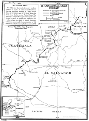
The El Salvador–Guatemala border is a line that separates the countries of El Salvador and Guatemala. It stretches for about 203 kilometers (126 miles) and runs from the northeast to the southwest. This important boundary helps define where each country's land begins and ends.
Contents
Where the Border Is Located
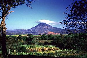
The border starts in the north where El Salvador, Guatemala, and Honduras all meet. This special spot is near a mountain peak called Monte Cristo, which is part of the Volcanoes National Park. From there, the border goes southwest all the way to the Pacific Ocean.
Natural Features of the Border
A big part of the border follows natural features. The final section near the Pacific Ocean follows the Rio Paz river. The border also crosses Lake Güija for about 2 miles (3.2 kilometers). In total, about 105 miles (169 kilometers) of the border follow rivers, and 19 miles (30.6 kilometers) are straight lines.
Areas Divided by the Border
The border separates different parts of each country. In Guatemala, it divides the department of Jutiapa. In El Salvador, it separates the departments of Ahuachapan (in the north) and Santa Ana.
Marking the Border
To make sure everyone knows exactly where the border is, 530 special markers called boundary pillars were put in place in 1940. These pillars act like signposts, showing the official line between the two nations.
See also
 In Spanish: Frontera entre Guatemala y El Salvador para niños
 | Dorothy Vaughan |
 | Charles Henry Turner |
 | Hildrus Poindexter |
 | Henry Cecil McBay |


