El Tornadizo facts for kids
Quick facts for kids
El Tornadizo
|
|||
|---|---|---|---|
 |
|||
|
|||

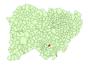
Location in Salamanca
|
|||
| Country | Spain | ||
| Autonomous community | Castile and León | ||
| Province | Salamanca | ||
| Comarca | Sierra de Francia | ||
| Area | |||
| • Total | 11 km2 (4 sq mi) | ||
| Elevation | 887 m (2,910 ft) | ||
| Population
(2018)
|
|||
| • Total | 98 | ||
| • Density | 8.9/km2 (23.1/sq mi) | ||
| Time zone | UTC+1 (CET) | ||
| • Summer (DST) | UTC+2 (CEST) | ||
| Postal code |
37765
|
||
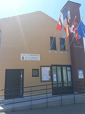
El Tornadizo is a small village and municipality located in western Spain. It is part of the Salamanca province and the Castile and León region. This charming village is about 61 kilometers (about 38 miles) away from Salamanca, the main city of the province. In 2018, only 98 people lived there, making it a very quiet and peaceful place.
Contents
Exploring El Tornadizo's Location
El Tornadizo is found in a beautiful part of Spain. It sits high up, about 887 meters (2,910 feet) above sea level. This means it's quite elevated, which can give it cooler temperatures and lovely views.
How Big is El Tornadizo?
The total area of the municipality is around 11 square kilometers (about 4.2 square miles). This makes it a relatively small area, easy to explore. The postal code for El Tornadizo is 37765.
Life and Work in El Tornadizo
The main way people in El Tornadizo earn a living is through agriculture. This means they work with the land, growing crops or raising animals.
Understanding the Local Economy
- Agriculture: This is the most important part of the economy. People here likely grow food or have farms. This helps provide fresh produce and supports the local community.
See also
In Spanish: El Tornadizo para niños


