Elemag Reef facts for kids
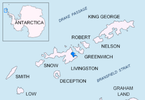
Elemag Reef is a special kind of underwater rock formation. It's located in Moon Bay, which is part of Livingston Island in the South Shetland Islands. These islands are found in the cold waters near Antarctica.
This reef is about 100 meters (328 feet) long and 40 meters (131 feet) wide. It also has a shallow area, called a shoal, that stretches out for more than 400 meters (1,312 feet) to the east. The reef covers an area of about 0.33 hectares (less than an acre).
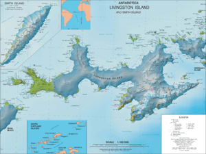
Elemag Reef is quite far from other landmarks. It's about 5.4 km (3.3 miles) south-southwest of Edinburgh Hill and 5.95 km (3.7 miles) west of Half Moon Island. It's also 5.18 km (3.2 miles) northwest of Rila Point, 3.3 km (2 miles) northeast of Zlatograd Rock, and 1.85 km (1.1 miles) east-southeast of Sindel Point.
How Elemag Reef Was Formed
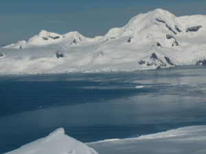
Elemag Reef was created by glaciers. Glaciers are huge, slow-moving rivers of ice. As they move, they pick up rocks and dirt. When glaciers melt or stop moving, they leave behind piles of these rocks and dirt. This material is called a moraine. Elemag Reef is a "moraine reef," meaning it's made from the rocky debris left by glaciers.
It formed where two glaciers, the Struma Glacier and the Huron Glacier, met and ended. This spot is called a glacier terminus. Originally, this area was known as Elemag Point.
Over the past few decades, the glaciers in this area have been melting and shrinking. This is called glacier retreat. Because of this retreat, which has been up to 1.8 km (1.1 miles) in some parts, the land changed, and what was once a point became the reef we see today. Bulgarian scientists mapped this area in 2009.
Who Was Elemag?
The reef is named after a historical figure called Elemag. He was an important governor of a place called Berat. This was during the final years of the First Bulgarian Empire, a powerful state that existed many centuries ago. Naming geographical features after historical figures is a common way to honor them and remember their legacy.


