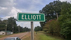
Elliott, Mississippi facts for kids
Quick facts for kids
Elliott, Mississippi
|
|
|---|---|
 |
|
| Country | United States |
| State | Mississippi |
| County | Grenada |
| Area | |
| • Total | 4.53 sq mi (11.72 km2) |
| • Land | 4.53 sq mi (11.72 km2) |
| • Water | 0.00 sq mi (0.00 km2) |
| Elevation | 226 ft (69 m) |
| Population
(2020)
|
|
| • Total | 880 |
| • Density | 194.48/sq mi (75.09/km2) |
| Time zone | UTC-6 (Central (CST)) |
| • Summer (DST) | UTC-5 (CDT) |
| ZIP code |
38926
|
| Area code(s) | 662 |
| GNIS feature ID | 691837 |
| FIPS code | 28-21940 |
Elliott is a small community in Grenada County, Mississippi, United States. It is known as an unincorporated community, which means it doesn't have its own local government like a city or town. It's also a census-designated place (CDP). This means the U.S. Census Bureau defines it for gathering population data. Elliott is part of the Grenada Micropolitan Statistical Area, which is a group of nearby communities connected by jobs and daily life.
In 2010, about 990 people lived in Elliott. By 2020, the population was 880.
Contents
Location and Geography
Elliott is found on the southern edge of Grenada County. Its southern border is right next to Montgomery County. The community is located along U.S. Route 51, a major highway.
Nearby Towns and Features
Elliott is about 7 miles (11 km) south of Grenada. Grenada is important because it is the county seat for Grenada County. This means it's where the main government offices for the county are located. Elliott is also about 4 miles (6 km) north of Duck Hill.
Just 3 miles (5 km) to the east of Elliott, you can find the Camp McCain Training Center. This is a training area for the Mississippi National Guard.
Land and Water
The U.S. Census Bureau says that Elliott covers an area of about 4.5 square miles (11.7 square kilometers). All of this area is land; there are no large bodies of water within the CDP. The community sits in a valley. This valley is formed by Batupan Bogue, which is a small stream. Batupan Bogue flows northwest and eventually joins the Yalobusha River.
Historical Connections
Elliott was once located along the route of the former Illinois Central Railroad. This railroad was very important for transportation and trade in the past. A post office served the Elliott community for many years, from 1860 until 1964.
Population Details
The population of Elliott has changed over the years. Here's a look at the numbers from recent censuses:
| Historical population | |||
|---|---|---|---|
| Census | Pop. | %± | |
| 2020 | 880 | — | |
| U.S. Decennial Census | |||
See also
 In Spanish: Elliott (Misisipi) para niños


