Embreeville, Pennsylvania facts for kids
Quick facts for kids
Embreeville, Pennsylvania
|
|
|---|---|
 |
|
| Country | United States |
| State | Pennsylvania |
| County | Chester |
| Township | Newlin |
| Time zone | UTC-5 (Eastern (EST)) |
| • Summer (DST) | UTC-4 (EDT) |
| ZIP codes |
19320
|
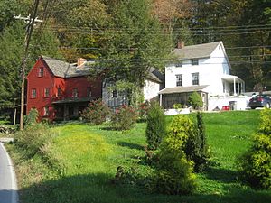
Embreeville is a small, historic community in Newlin Township, Pennsylvania, United States. It's located along the Brandywine Creek. This area is about 30 miles (48 km) west of Philadelphia.
Embreeville is mostly a rural area with a few homes and businesses. Many of its old buildings are part of the Embreeville Historic District. This district is listed on the National Register of Historic Places because of its important history.
Contents
Exploring Embreeville's History
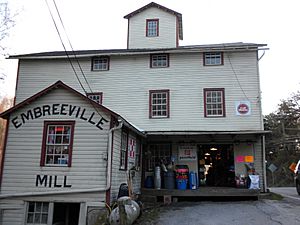
Embreeville has several interesting landmarks that tell its story. These include the Embreeville Dam and the old Embreeville Mill. The area also has a Pennsylvania State Police Barracks.
The Star Gazers' Stone
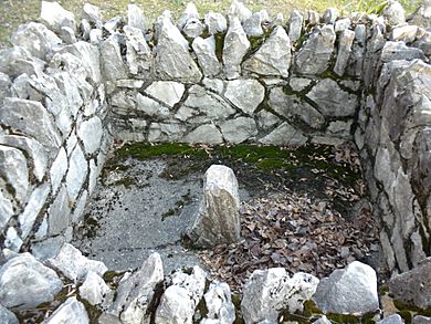
One of the most famous landmarks is the Star Gazers' Stone. This stone is very important in American history. In 1764, two astronomers, Charles Mason and Jeremiah Dixon, used this spot. They were surveying the Mason-Dixon line. This line is a famous boundary that separates several states. The stone helped them make accurate measurements.
Embreeville's Past Institutions
For many years in the 1800s and 1900s, Embreeville was known for a large county institution. This place helped people in need. It later became a hospital for mental health care, known as Embreeville State Hospital from 1938. The hospital closed in 1980.
Hannah Freeman's Grave
Another historical site in Embreeville is the grave of Hannah Freeman. She was a Native American woman from the Lenape tribe. Her story is an important part of the local history.
 | Aurelia Browder |
 | Nannie Helen Burroughs |
 | Michelle Alexander |


