Embryo Lake facts for kids
Quick facts for kids Embryo Lake |
|
|---|---|
| Location | Kenora District, Ontario |
| Coordinates | 50°57′25″N 94°22′18″W / 50.95694°N 94.37167°W |
| Type | lake |
| Part of | Hudson Bay drainage basin |
| Primary outflows | Rostoul River |
| Basin countries | Canada |
| Max. length | 7.1 km (4.4 mi) |
| Max. width | 1.8 km (1.1 mi) |
| Surface elevation | 381 m (1,250 ft) |
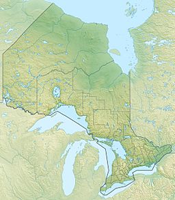
Embryo Lake is a lake located in the northwestern part of Ontario, Canada. It is a special place because it is found inside Woodland Caribou Provincial Park. This lake is also very important as it is where the Rostoul River begins its journey.
About Embryo Lake
Embryo Lake is part of a very large water system called the Hudson Bay drainage basin. This means that all the water from the lake eventually flows towards Hudson Bay. The lake itself is about 7.1 kilometers (4.4 miles) long and 1.8 kilometers (1.1 miles) wide. It sits at an elevation of 381 meters (1,250 feet) above sea level.
Where is Embryo Lake?
Embryo Lake is in an area of Kenora District in Ontario, Canada that is not organized into towns or cities. This remote location helps keep the lake and its surroundings wild and natural. Being inside Woodland Caribou Provincial Park also protects its environment.
How Water Flows In and Out
Water flows into Embryo Lake from three smaller, unnamed streams. These streams enter the lake from the northeast, northwest, and west sides. The main river that flows out of Embryo Lake is the Rostoul River. It starts at the southwest end of the lake and flows into another lake called Telescope Lake.
A Big Water Journey
The water from Embryo Lake, carried by the Rostoul River, goes on a long journey. After leaving Telescope Lake, the water flows into the Gammon River. From there, it joins the Bloodvein River, which then empties into Lake Winnipeg. Finally, the water travels through the Nelson River all the way to Hudson Bay. This shows how Embryo Lake is connected to a huge network of rivers and lakes across Canada.


