Englewood Dam facts for kids
Quick facts for kids Englewood Dam |
|
|---|---|
|
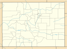
Location of Englewood Dam in Colorado
|
|
| Country | United States |
| Location | Arapahoe County, Colorado, USA |
| Coordinates | 39°35′21.96″N 104°55′08.92″W / 39.5894333°N 104.9191444°W |
| Purpose | Flood control |
| Status | Operational |
| Construction began | 1936 |
| Opening date | 1936 |
| Owner(s) | Urban Drainage and Flood Control District |
| Dam and spillways | |
| Type of dam | Embankment, earth-fill |
| Impounds | Willow Creek |
| Height | 50 ft (15 m) |
| Length | 1,700 ft (520 m) |
| Elevation at crest | 5,606 acre⋅ft (6,915,000 m3) |
| Width (crest) | 20 ft (6.1 m) |
| Reservoir | |
| Total capacity | 1,485 acre⋅ft (1,832,000 m3) |
| Catchment area | 11 sq mi (28 km2) |
The Englewood Dam is a special structure built in 1936. It's located in Arapahoe County, Colorado, United States. This dam helps control floods on a waterway called Little Dry Creek. It's about 9 mi (14 km) upstream from the city of Englewood.
What is Englewood Dam?
The Englewood Dam is an embankment dam, which means it's made mostly of earth and rock. It's designed to hold back water during heavy rains. This helps prevent flooding in areas downstream, like the city of Englewood. The dam is about 50 ft (15 m) tall and 1,700 ft (520 m) long. That's like standing on top of a five-story building and looking across five football fields!
Why Was It Built?
The dam was built during a tough time in American history called the Great Depression. Many people didn't have jobs. The government started a program called the Works Progress Administration (WPA). The WPA hired people to build important projects like roads, parks, and dams. Englewood Dam was one of these projects, giving jobs to people and protecting communities from floods. Its main job is flood retention, which means it holds back floodwaters.
How Does It Work?
The dam helps manage the water from about 11 sq mi (28 km2) of the Little Dry Creek area. This area is called a drainage basin. When it rains a lot, water flows into this basin and then into the creek. The dam has a storage space that can hold about 1,485 acre⋅ft (1,832,000 m3) of water. This is a huge amount, but the area behind the dam, called the reservoir, is usually dry. It only fills up when there's a lot of rain or melting snow. This temporary storage keeps the water from rushing downstream and causing damage.
Who Manages the Dam?
The Englewood Dam was bought by the Urban Drainage and Flood Control District in 1973. This group is in charge of managing and improving systems that control floods in urban areas. They made upgrades to the dam between 1973 and 1975 to make sure it could do its job well. The dam is located near Centennial, Colorado, within the Willow Springs Open Space. This open space is part of the South Suburban Park and Recreation District, which means it's also a place where people can enjoy nature.
 This article incorporates public domain material from the United States Government document "Report on the Floods of June 1965 (U.S. Army Corps of Engineers)".


