Enjalran River facts for kids
Quick facts for kids Enjalran |
|
|---|---|

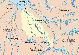
Harricana River basin in yellow
|
|
| Other name(s) | Old name: "Hundredmile River" |
| Country | Canada |
| Province | Quebec |
| Region | Nord-du-Québec |
| Physical characteristics | |
| Main source | Lake Enjalran Eeyou Istchee Baie-James (municipality), Nord-du-Québec, Quebec 253 m (830 ft) 48°54′20″N 78°57′24″W / 48.90556°N 78.95667°W |
| River mouth | Turgeon River (Harricana River) Eeyou Istchee Baie-James (municipality), Nord-du-Québec, Quebec 246 m (807 ft) 49°50′28″N 79°24′33″W / 49.84111°N 79.40917°W |
| Length | 10.6 km (6.6 mi) |
| Basin features | |
| Tributaries |
|
The Enjalran River is a small river in Quebec, Canada. It flows into the Turgeon River. This river is located in the area of Eeyou Istchee Baie-James, which is part of the Nord-du-Québec region.
The main activities around the river are forestry, which means cutting down trees for wood. Recreational tourism is also popular. People enjoy visiting the area for fun activities.
The river's surface usually freezes over in late November. It stays frozen until the end of April. It is generally safe to walk or travel on the ice from early December to mid-April.
Contents
Where is the Enjalran River?
The Enjalran River is surrounded by other rivers and creeks. These are like its neighbors in the water system:
- North side: The Turgeon River and Quésagami Creek.
- East side: Santoire Creek and the Théo River.
- South side: Enjalran Lake, the Turgeon River, and Makwo Creek.
- West side: The Turgeon River and Kaokonimawaga Creek.
The River's Beginning
The Enjalran River starts from Lake Enjalran. This lake is about 3 kilometers (1.9 miles) long. It sits at an elevation of 253 meters (830 feet) above sea level.
The lake is located in Enjalran Township. Here are some interesting facts about its location:
- It is about 2.7 kilometers (1.7 miles) west of the Enjalran Hills. These hills have a peak of 319 meters (1,047 feet).
- It is about 10.8 kilometers (6.7 miles) east of the border between Ontario and Quebec.
- It is about 7.4 kilometers (4.6 miles) south of where the Enjalran River ends.
- It is about 109.6 kilometers (68.1 miles) northeast of the town of La Sarre.
How the River Flows
From Lake Enjalran, the river flows for about 10.6 kilometers (6.6 miles). It flows mostly through a forest area.
Here is how the river flows:
- It flows north for about 6.4 kilometers (4.0 miles). It passes the outlet of Lac Chicoyne, which joins it from the east.
- Then, it continues north for about 1.5 kilometers (0.93 miles). It passes the outlet of Lake Henri, which joins it from the northeast.
- Finally, it flows north for another 2.7 kilometers (1.7 miles) until it reaches its mouth.
The River's End
The Enjalran River ends by flowing into the east bank of the Turgeon River. This meeting point is also in a forest area.
Here are some details about where the river ends:
- It is about 12.4 kilometers (7.7 miles) upstream from where the Detour River joins the Turgeon River.
- It is about 8.3 kilometers (5.2 miles) east of the Ontario-Quebec border.
- It is about 38.4 kilometers (23.9 miles) southeast of the mouth of the Turgeon River.
- It is about 116.8 kilometers (72.6 miles) north of the city center of La Sarre, Quebec.
What's in a Name?
The name "Enjalran" comes from a French family name. This name is used for several places in the same area of northwestern Quebec.
You can find these places with the name "Enjalran":
- Enjalran Township
- Enjalran Hills
- Enjalran River (this one!)
- Enjalran Lake
The name "Enjalran River" was officially recognized on December 5, 1968. This happened when the Commission de toponymie du Québec (Quebec Place Names Commission) was created.
 | Georgia Louise Harris Brown |
 | Julian Abele |
 | Norma Merrick Sklarek |
 | William Sidney Pittman |

