Detour River facts for kids
Quick facts for kids Detour |
|
|---|---|

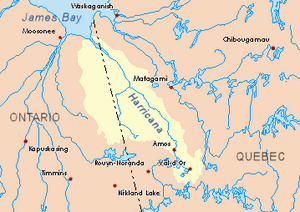
Harricana River basin in yellow
|
|
| Country | Canada |
| Provinces | |
| District | Cochrane |
| Physical characteristics | |
| Main source | Turgeon Lake Eeyou Istchee Baie-James (municipality), Nord-du-Québec, Quebec 313 m (1,027 ft) 49°43′44″N 79°51′39″W / 49.72889°N 79.86083°W |
| River mouth | Turgeon River Eeyou Istchee Baie-James (municipalité), Quebec 246 m (807 ft) 49°56′20″N 79°25′30″W / 49.93889°N 79.42500°W |
| Length | 80.0 km (49.7 mi) |
| Basin features | |
| Tributaries |
|
The Detour River is a river in Canada. It flows through two different areas: Ontario (in a part called Cochrane District) and Quebec (in a municipality called Eeyou Istchee Baie-James). The Detour River is a branch of the Turgeon River.
Contents
Where Does the Detour River Flow?
The Detour River starts in Northeastern Ontario. It begins at a lake called "Upper Lake Detour," which is about 2.4 kilometers (1.5 miles) long. This lake is located near other rivers like the Lawagamau River and the Chabbie River.
The River's Journey in Ontario
From "Upper Detour Lake," the Detour River flows for about 80 kilometers (50 miles). It travels north, then east, collecting water from smaller streams along the way. The river passes by Monaghan Lake and then flows northeast. It also runs along the eastern side of Detour Lake, which is about 4 kilometers (2.5 miles) long. Many smaller lakes feed into Detour Lake. Further along, the river reaches Lower Detour Lake, which is about 5.5 kilometers (3.4 miles) long. This lake also gets water from other lakes, like Stake Lake. Finally, the Detour River flows east and south through marshy areas until it reaches the border with Quebec.
The River's Journey in Quebec
Once the Detour River crosses into Quebec, it flows for about 9.8 kilometers (6.1 miles) eastward. In this part of its journey, it collects water from several other streams and lakes. These include "Sunday Creek," which brings water from lakes in Ontario like Kitchin Lake and Sunday Lake. It also receives water from Lambert Lake and Geoffrion Lake in Quebec. The Geoffrion Lake branch also drains wetlands that extend into Ontario. The Detour River then joins the Turgeon River. Its mouth, where it meets the Turgeon River, is about 52 kilometers (32 miles) upstream from where the Turgeon River itself ends.
What's in a Name?
The names of several places in this area are connected to the Detour River. These include "Upper Detour Lake," "Little Detour Lake," "Detour Lake," and "Lower Detour Lake." The name "Detour River" (or "rivière de Détour" in French) was officially recorded on December 5, 1968. This was done by the Commission de toponymie du Québec, which is like a special committee that names places in Quebec.
 | Delilah Pierce |
 | Gordon Parks |
 | Augusta Savage |
 | Charles Ethan Porter |

