Escambray Mountains facts for kids
Quick facts for kids Escambray |
|
|---|---|

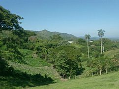
South side of Escambray in Sancti Spíritus Province with Valley of the sugar mills at the front.
|
|
| Highest point | |
| Peak | Pico San Juan |
| Elevation | 1,140 m (3,740 ft) |
| Geography | |
| Country | Cuba |
| Range coordinates | 21°59′05″N 80°07′57″W / 21.98472°N 80.13250°W |
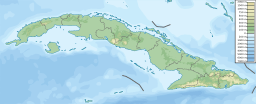
The Escambray Mountains (called Sierra del Escambray in Spanish) are a beautiful mountain range in the middle of Cuba. They stretch across three provinces: Sancti Spíritus, Cienfuegos, and Villa Clara. These mountains are known for their stunning natural beauty and important history.
About the Escambray Mountains
The Escambray Mountains are found in the south-central part of Cuba. They are about 80 kilometers (50 miles) long from east to west. They are also about 80 kilometers (50 miles) wide from north to south.
The tallest point in the range is Pico San Juan. This peak rises to 960 meters (3,150 feet) above sea level. The Escambray range is split into two main parts by the Agabama River. The western part is known as the Guamuhaya Mountains. The eastern part, located between Trinidad and Sancti Spiritus, is called Sierra de Sancti Spíritus.
Besides Pico San Juan, other high points in the Escambray Mountains include:
- Caballete de Casas
- Gavilanes
- Loma de Banao
- Caja de Agua
- Pico Tuerto
Nature and History
The Escambray Mountains are home to amazing natural areas. Topes de Collantes is a special nature reserve park. It is located in the southeastern part of the mountains. This park helps protect many caves, rivers, waterfalls, and canyons. It's a great place to explore nature.
At the southeastern base of the mountains, you'll find the Valley de los Ingenios. This area is very important historically. It is a UNESCO World Heritage Site. This means it is recognized globally for its special cultural or natural value.
The mountains also played a role in Cuba's history. They were a significant location during a period of historical events between 1959 and 1965.
Gallery
-
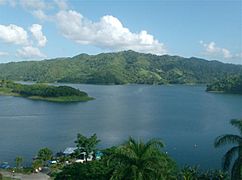
Escambray near Hanabanilla lake in Villa Clara Province
-
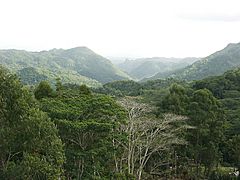
Tropical rain forest in the heart of Topes de Collantes, Sancti Spíritus Province
-
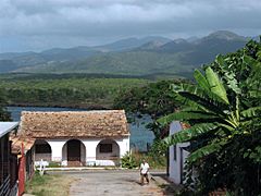
La Boca fisherman's village near Trinidad with Escambray in the background
-
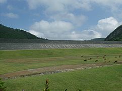
Hanabanilla lake wall, in the village of Jibacoa, in Villa Clara, Escambray.
See also
 In Spanish: Escambray para niños
- Geography of Cuba
 | Georgia Louise Harris Brown |
 | Julian Abele |
 | Norma Merrick Sklarek |
 | William Sidney Pittman |


