Estuary of Bilbao facts for kids
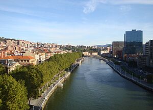
The Estuary of Bilbao (in Spanish: Ría de Bilbao; in Basque: Bilboko Itsasadarra) is where several rivers meet the sea. These rivers are the Nervion, Ibaizabal, and Cadagua. They drain much of Biscay and parts of Alava in the Basque Country, Spain.
This estuary is like a mix of a river and a bay. It stretches about 16 kilometers (10 miles) inland into the city of Bilbao, starting from the Bilbao Abra bay. The port of Bilbao used to be along its entire length. However, parts of the estuary closer to the city have been cleaned up. They are now used for city improvements. The main port activities are moving to the coast at Santurtzi and Zierbena.
Downstream from Bilbao, the estuary divides the metropolitan area. It creates a left bank with towns like Barakaldo, Sestao, Portugalete, and Santurtzi. On the other side is the right bank with Erandio, Leioa, and Getxo.
Cleaning Up the Estuary
The Estuary of Bilbao has always been very important to the city. Bilbao started over 700 years ago as a trading village. It grew along the Nervión river until it reached the sea.
Sadly, the river became very polluted. This happened because of all the factories and industries nearby in the last century. But in recent years, a lot of hard work has been done. People have worked to clean up the estuary. This effort has helped bring the river back to life.
See also
 In Spanish: Ría de Bilbao para niños
 | Dorothy Vaughan |
 | Charles Henry Turner |
 | Hildrus Poindexter |
 | Henry Cecil McBay |


