Exmore, Virginia facts for kids
Quick facts for kids
Exmore, Virginia
|
|
|---|---|

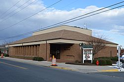
Town hall
|
|
| Motto(s):
"The Treasure of Virginia's Eastern Shore"
|
|

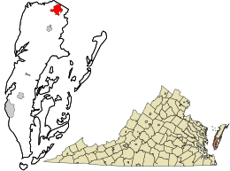
Location in Northampton County and the state of Virginia.
|
|
| Country | United States |
| State | Virginia |
| County | Northampton |
| Area | |
| • Total | 2.60 sq mi (6.74 km2) |
| • Land | 2.60 sq mi (6.74 km2) |
| • Water | 0.00 sq mi (0.00 km2) |
| Elevation | 33 ft (10 m) |
| Population
(2020)
|
|
| • Total | 1,473 |
| • Density | 566.3/sq mi (218.7/km2) |
| Time zone | UTC−5 (Eastern (EST)) |
| • Summer (DST) | UTC−4 (EDT) |
| ZIP code |
23350
|
| Area code(s) | 757, 948 (auto) |
| FIPS code | 51-26416 |
| GNIS feature ID | 1466377 |
| Website | Official website: http://www.exmore.org/ |
Exmore is the biggest town in Northampton County. It is located on the Eastern Shore of the U.S. state of Virginia. In 2020, about 1,473 people lived there.
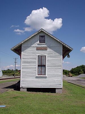
There are a couple of ideas about how Exmore got its name. One popular story says it was the tenth train station south of the Delaware state line. So, people would say there were "X more" stations to go. Another idea is that it was named after Exmoor, a place in England. This second idea makes more sense because many towns in Virginia were named after places in England. For example, Northampton County itself is named after Northamptonshire.
Contents
A Look Back in Time
Some important old buildings in Exmore are listed on the National Register of Historic Places. These include Benjamin's Department Store and the John W. Chandler House.
The Virginia Barrier Island Center (BIC) is a great place to learn about the local history and culture. It opened in 2002 on a farm in Machipongo. This is about 10 miles south of Exmore. The BIC is a museum and a place for events. Its main goal is to save and share the history of Virginia's barrier islands. They do this through education and by collecting old items. The museum has over 7,500 items and a permanent exhibit.
Where Exmore Is Located
According to the United States Census Bureau, the town of Exmore covers about 2.6 square miles (6.7 square kilometers). All of this area is land.
People of Exmore
| Historical population | |||
|---|---|---|---|
| Census | Pop. | %± | |
| 1950 | 1,362 | — | |
| 1960 | 1,566 | 15.0% | |
| 1970 | 1,421 | −9.3% | |
| 1980 | 1,300 | −8.5% | |
| 1990 | 1,115 | −14.2% | |
| 2000 | 1,136 | 1.9% | |
| 2010 | 1,460 | 28.5% | |
| 2020 | 1,473 | 0.9% | |
| U.S. Decennial Census | |||
In 2000, there were 1,136 people living in Exmore. There were 475 households, which are groups of people living together. About 317 of these were families. The town had about 1,405 people per square mile.
The people living in Exmore came from different backgrounds. Most were White (about 63%). About 34% were African American. A small number were Native American, Asian, or Pacific Islander. Some people were from other races or from two or more races. About 2.5% of the population was Hispanic or Latino.
In 2000, about 25% of the people in Exmore were under 18 years old. About 19% were 65 years or older. The average age in the town was 39 years.
Getting Around Exmore
Main Roads
 US 13
US 13 SR 178
Public Transport
STAR Transit offers public transportation services. These services connect Exmore with other towns. You can travel to places like Cape Charles and Onley. These towns are also on the Eastern Shore.
Railroads
The Bay Coast Railroad used to provide train services for goods in Exmore. However, they stopped operating in 2018.
See also
 In Spanish: Exmore para niños
 | William M. Jackson |
 | Juan E. Gilbert |
 | Neil deGrasse Tyson |


