Fan Bwlch Chwyth facts for kids
Quick facts for kids Fan Bwlch Chwyth |
|
|---|---|

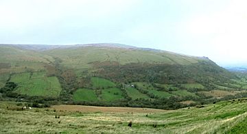
Fan Bwlch Chwyth viewed from the south
|
|
| Highest point | |
| Elevation | 603 m (1,978 ft) |
| Geography | |
| Location | Powys, Wales |
| Parent range | Brecon Beacons |
| OS grid | SN912217 |
Fan Bwlch Chwyth is a mountain peak located in the Fforest Fawr area. This area is part of the beautiful Brecon Beacons National Park in Wales. The mountain is found within the county of Powys. Its highest point, called the summit, is 603 meters (about 1,978 feet) high. You can find a special marker called a trig point at the very top. This marker helps people know the exact location and height of the peak.
Contents
How the Mountain Was Formed
Rocks and Ancient Times
Fan Bwlch Chwyth is made from special types of rock. These rocks are called sandstones and mudstones. They belong to formations known as the Senni Beds and Brownstones. All these rocks are part of the Old Red Sandstone. They were formed a very long time ago, during a period called the Devonian period. This was millions of years ago, when different kinds of plants and fish were just starting to appear.
Ice Age Impact
The steepest side of Fan Bwlch Chwyth faces northeast. This steep shape was created during the Ice Ages. During these times, a small glacier grew right on this spot. A glacier is like a huge, slow-moving river of ice. As the glacier moved, it carved out the mountain's side.
Glacial Features and Quarry
When the glacier melted, it left behind some interesting features. You can still see two curved piles of rock and dirt called moraines. These are easy to spot from the nearby walking path. The rock face that the glacier carved has also been used as a quarry. A quarry is a place where rocks are dug out of the ground. This quarry is very important for science. It is officially named a Site of Special Scientific Interest. This means it's a protected area because of its unique geology.
Exploring Fan Bwlch Chwyth
Walking and Trails
The entire area around Fan Bwlch Chwyth is open country. This means you can walk and explore almost anywhere you like. There is a special path called a bridleway that starts from a small road. This road is located between Heol Senni and the A4067 road.
Following the Path
The bridleway goes southeast and partly follows an old vehicle track. This track leads to the disused quarry. Even though it's a track, regular cars are not allowed on it. It's a great path for walkers and people on horseback to enjoy the beautiful scenery.
 | Aurelia Browder |
 | Nannie Helen Burroughs |
 | Michelle Alexander |

