Faraid Head facts for kids
Quick facts for kids Faraid Head |
|
|---|---|
| An Fharaird (Scottish Gaelic) | |

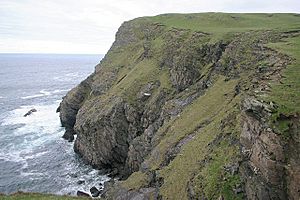
Faraid Head, looking north-eastwards from Poll a'Gheodha Bhain
|
|
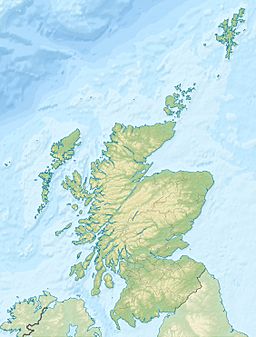
| Location | Scotland |
| Coordinates | 58°36′12″N 4°46′33″W / 58.60333°N 4.77583°W |
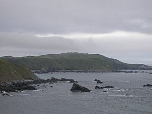
Faraid Head (which is An Fharaird in Scottish Gaelic) is a small piece of land that sticks out into the sea. It's found on the northern coast of Sutherland, in the Highland area of Scotland. This headland is about 2 kilometres (1.2 miles) north of the small village of Balnakeil. It's also about 3 kilometres (1.9 miles) north of Durness.
What is Faraid Head?
Faraid Head is a peninsula, which means it's land surrounded by water on three sides. It's a really interesting place with a mix of natural beauty and some history. The area is known for its amazing views and unique landscape.
Military History at Faraid Head
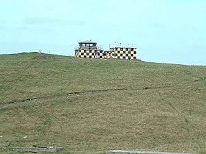
A small radar station was built at Faraid Head in the 1950s. Its job was to help watch the skies over Scotland's north coast. This station was part of a system called ROTOR. However, by the time it was finished, the ROTOR system was already old-fashioned.
So, the station was closed down, but it stayed under the control of the Ministry of Defence. Later on, the main building was updated. It became a control tower for military training areas nearby. These areas include Cape Wrath and Garvie Island, which are used for practice.
Amazing Sand Dunes
Faraid Head is also famous for its huge sand dunes. These dunes are large piles of sand shaped by the wind. They are a very important part of the landscape here. The dunes at Faraid Head are part of a bigger protected area. This area is called the Oldshoremore, Cape Wrath and Durness Special Landscape Area. It helps to protect the beautiful natural environment.
 | Ernest Everett Just |
 | Mary Jackson |
 | Emmett Chappelle |
 | Marie Maynard Daly |


