Farallón, Cayey, Puerto Rico facts for kids
Quick facts for kids
Farallón
|
|
|---|---|
|
Barrio
|
|

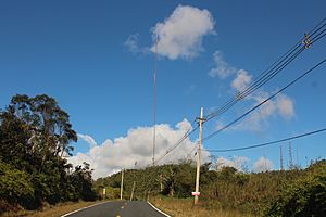
Puerto Rico Highway 184 in Farallón
|
|

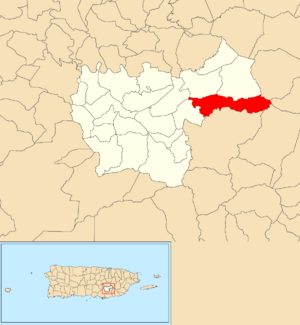
Location of Farallón within the municipality of Cayey shown in red
|
|
| Commonwealth | |
| Municipality | |
| Area | |
| • Total | 3.52 sq mi (9.1 km2) |
| • Land | 3.52 sq mi (9.1 km2) |
| • Water | 0 sq mi (0 km2) |
| Elevation | 2,228 ft (679 m) |
| Population
(2010)
|
|
| • Total | 451 |
| • Density | 128.1/sq mi (49.5/km2) |
| Source: 2010 Census | |
| Time zone | UTC−4 (AST) |
Farallón is a small community, also known as a "barrio," located in the municipality of Cayey, Puerto Rico. It is a quiet area where people live. In 2010, about 451 people lived in Farallón.
A Glimpse into Farallón's History
The history of Farallón is part of the larger story of Puerto Rico. After the Spanish–American War in 1898, Spain gave Puerto Rico to the United States. This happened under the rules of the Treaty of Paris of 1898. Puerto Rico then became an "unincorporated territory" of the United States. This means it is a part of the U.S. but does not have all the same rights as a state.
Early Population Counts
In 1899, the United States Department of War took a count of all the people in Puerto Rico. This count is called a census. The census found that the combined population of Farallón and two nearby barrios, Cedro and Vegas, was 1,043 people.
| Historical population | |||
|---|---|---|---|
| Census | Pop. | %± | |
| 1950 | 851 | — | |
| 1980 | 583 | — | |
| 1990 | 671 | 15.1% | |
| 2000 | 623 | −7.2% | |
| 2010 | 451 | −27.6% | |
| U.S. Decennial Census 1899 (shown as 1900) 1910-1930 1930-1950 1980-2000 2010 |
|||
See also
 In Spanish: Farallón (Cayey) para niños
- List of communities in Puerto Rico
 | Sharif Bey |
 | Hale Woodruff |
 | Richmond Barthé |
 | Purvis Young |


