Farleigh Hill facts for kids
Quick facts for kids Farleigh Hill |
|
|---|---|

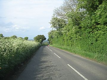
Road at the summit of Farleigh Hill as it begins to descend into Cliddesden
|
|
| Highest point | |
| Elevation | 208 m (682 ft) |
| Prominence | 34 m (112 ft) |
| Parent peak | Butser Hill |
| Listing | TuMP |
| Geography | |
| Location | Hampshire, England |
| Parent range | Hampshire Downs |
| OS grid | SU616472 |
| Topo map | OS Landranger |
Farleigh Hill is one of the highest points in the county of Hampshire, England. It's part of the Hampshire Downs and stands 208 metres (682 ft) above sea level. Its height makes it a notable landmark in the area.
Exploring Farleigh Hill
Farleigh Hill is located about 1 kilometre southeast of the M3 motorway. It's also close to the edge of Basingstoke in Hampshire.
Roads and Nearby Places
A road called the B 3046 crosses over the hill. It runs from the southwest to the northeast. This road passes very close to the highest point of the hill. You can find houses and lodges nearby. Farleigh House School and the village of Farleigh Wallop are on the southeastern side of the hill. The village of Cliddesden is also on the same road, about 2 kilometres to the northeast.
Black History Month on Kiddle
Outstanding African-American Women
 | Jewel Prestage |
 | Ella Baker |
 | Fannie Lou Hamer |

All content from Kiddle encyclopedia articles (including the article images and facts) can be freely used under Attribution-ShareAlike license, unless stated otherwise. Cite this article:
Farleigh Hill Facts for Kids. Kiddle Encyclopedia.
