Fern Tree, Tasmania facts for kids
Quick facts for kids Fern TreeHobart, Tasmania |
|||||||||||||||
|---|---|---|---|---|---|---|---|---|---|---|---|---|---|---|---|
| Population | 726 (2016 census) | ||||||||||||||
| • Density | 84.3/km2 (218/sq mi) | ||||||||||||||
| Postcode(s) | 7054 | ||||||||||||||
| Area | 7.9 km2 (3.1 sq mi) | ||||||||||||||
| Location | 9 km (6 mi) SW of Hobart | ||||||||||||||
| LGA(s) | City of Hobart, Kingborough Council | ||||||||||||||
| Region | Hobart | ||||||||||||||
| State electorate(s) | Clark | ||||||||||||||
| Federal Division(s) | Clark | ||||||||||||||
|
|||||||||||||||
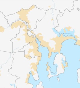
Fern Tree is a lovely area in Tasmania, Australia. It's a mix of country and town living. This place is about 9 kilometers (about 5.6 miles) south-west of the city of Hobart.
In 2016, about 726 people lived in Fern Tree. The name "Fern Tree" comes from the Dicksonia antarctica, which is a type of Tasmanian tree fern. These ferns grow everywhere in the area! Fern Tree sits right below Mount Wellington. This mountain is super tall, reaching 1270 meters (about 4,167 feet) above sea level.
Contents
A Look Back: History of Fern Tree
Fern Tree officially became a recognized place in 1963. But people have lived there for much longer!
Early Days and Water Supply
Long ago, Fern Tree was a stop for mail on the way to the Huon Valley. It also became very important for Hobart's water supply. Water from the mountains flowed through Fern Tree to the city.
A Place for Fun and Nature
People started settling in Fern Tree in the mid-1800s. Since then, it has always been a popular spot for people from Hobart to relax and have fun. There are many walking tracks, like the famous Pipeline Track. These trails let both locals and visitors enjoy the amazing plants and animals.
The Fern Tree Tavern
The first Fern Tree Tavern was built way back in 1861. It was a popular place for people to gather. Later, a new hotel, the Fern Tree Hotel, was built. Sadly, this hotel burned down in the big bushfires of 1967. But don't worry, a new, modern Fern Tree Tavern was built in its place!
Exploring Fern Tree's Geography
Fern Tree has some cool natural features. The Browns River forms part of its south-western border. Smaller streams, like Long Creek and Dunns Creek, also flow through the area. They help make up other parts of the boundaries.
Getting Around: Roads in Fern Tree
The main road that goes through Fern Tree is called Route B64, also known as Huon Road. It runs from the north to the south-west of the area. This road helps people travel to and from Fern Tree.
 | Victor J. Glover |
 | Yvonne Cagle |
 | Jeanette Epps |
 | Bernard A. Harris Jr. |


