Mount Wellington (Tasmania) facts for kids
Quick facts for kids Mount Wellington |
|
|---|---|
| kunanyi | |
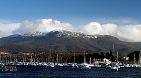
Mount Wellington viewed from Lindisfarne Bay on the Eastern Shore of the River Derwent, with its seasonal snow cap visible
|
|
| Highest point | |
| Elevation | 1,271 m (4,170 ft) |
| Prominence | 693 m (2,274 ft) |
| Isolation | 47.56 km (29.55 mi) |
| Listing | 49th highest mountain of Tasmania |
| Geography | |
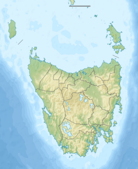
| Location | South East Tasmania, Australia |
| Parent range | Wellington |
| Geology | |
| Mountain type | Dolerite |
| Climbing | |
| First ascent |
|
| Easiest route | Hike, road |
Mount Wellington, also known as kunanyi (palawa kani: /kuːˈnɑːnjiː/), is a famous mountain in south-east Tasmania, Australia. It is the highest point of the Wellington Range and is part of the Wellington Park reserve. The city of Hobart, Tasmania's capital, sits right at the base of this mountain.
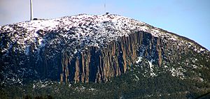
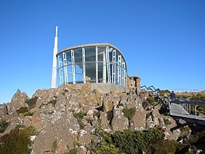
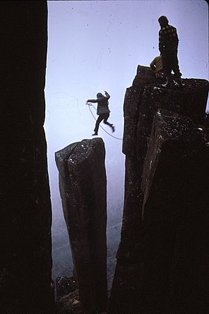
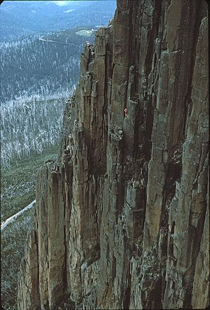
Mount Wellington stands 1,271 metres (4,170 ft) above sea level. It often gets covered in snow, even sometimes in summer! The lower parts of the mountain are thick with trees and have many walking paths and fire trails. There's also a paved road that goes all the way to the top, about 22 kilometres (14 mi) from Hobart's city center. From a special lookout near the summit, you can see amazing views of the city below, the Derwent estuary, and even parts of a World Heritage Area almost 100 kilometres (62 mi) away. One of the most recognizable features of Mount Wellington from Hobart is a tall cliff made of dolerite rock columns, known as the Organ Pipes.
Contents
How Mount Wellington Formed: Its Geology
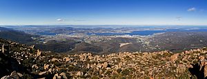
The lower areas and foothills of Mount Wellington were created slowly. Millions of years ago, the entire Hobart region was a shallow seabed. The upper parts of the mountain formed in a more dramatic way. They were created when hot, melted rock pushed up from deep inside the Earth. This molten rock squeezed sideways between older rock layers, forming a flat, thick sheet called a sill. This happened as the Australian continent slowly pulled away from Antarctica and separated from the supercontinent Gondwana over 40 million years ago.
The Original Name: Aboriginal History
The Aboriginal people who lived in this area called Mount Wellington kunanyi. They also used other names like ungyhaletta, poorawetter, pooranetere, or pooranetteri. Today, the Palawa people, who are descendants of the original Aboriginal Tasmanians, often prefer the name kunanyi. In 2013, the Tasmanian government decided to use two names for important places. This led to the mountain officially being called "kunanyi / Mount Wellington."
Mount Wellington's European History
The first European to record visiting Tasmania was Abel Tasman in 1642. He likely didn't see Mount Wellington because his ship stayed far out at sea.
Other Europeans didn't visit Tasmania until the late 1700s. Several explorers came to southern Tasmania, which was then called Van Diemens Land. These included French explorer Marc-Joseph Marion du Fresne (1772), and English explorers Tobias Furneaux (1773), James Cook (1777), and William Bligh (1788 and 1792). Another French expedition led by Bruni d'Entrecasteaux visited in 1792–93. In 1793, John Hayes arrived at the River Derwent and named the mountain Skiddaw, after a mountain in England. However, this name didn't become popular.
In 1798, Matthew Flinders and George Bass sailed all the way around Tasmania. While resting in the area, Flinders named the river the River Derwent. He called the mountain "Table Mountain" because it looked similar to Table Mountain in South Africa. The British first settled in Hobart in 1804, and Flinders' name "Table Mountain" became widely used. This name stuck until 1832. Then, it was decided to rename the mountain in honor of the Duke of Wellington. He was a famous military leader who, along with Gebhard Leberecht von Blücher, defeated Napoleon at the Battle of Waterloo in 1815.
In February 1836, the famous scientist Charles Darwin visited Hobart Town and climbed Mount Wellington.
The first weather station on Mount Wellington was set up in 1895 by Clement Lindley Wragge.
Mount Wellington has been a place where some interesting characters have lived. For example, a bushranger named John "Rocky" Whelan lived in a cave there in the mid-1800s. This cave is now known as "Rocky Whelan's Cave" and is an easy walk from a spot called the Springs.
Mountain Development and Access
For many years, Mount Wellington was a popular place for people from Hobart to visit for a day. Many small huts were built on the lower slopes for visitors. Sadly, all these early huts were destroyed in the big bushfires of 1967. Today, there are modern huts open to the public at places like the Springs, the Pinnacle, and the Chalet, which is a picnic spot.
The road to the summit, called the Pinnacle Drive, was built in the early 1930s. It was a project to help people who didn't have jobs during that time. This idea came from Albert Ogilvie, who was the premier of Tasmania. When the road was first built, the mountain had been heavily logged and looked quite bare. The road was very noticeable and was sometimes called "Ogilvie's Scar." Today, the trees have grown back, making the mountain green again. The road was officially opened on January 23, 1937, by Governor Sir Ernest Clark, after two years of construction.
The road is used by tourists during the day. Parts of it can close at any time of year if there's snow or ice. About halfway up the road, at 720 meters, there's a picnic area called "The Springs." This is where a chalet (a type of lodge) and health spa once stood before being destroyed by the 1967 bushfire.
Broadcast Towers on the Summit
Mount Wellington is a great spot for radio and television broadcasters because its high position allows signals to reach a large area of Hobart and nearby districts.
Two tall steel towers were put up in 1960 to send out television signals across Tasmania. One was called the Post Master General (PMG) tower, and the other belonged to WIN Corporation. The WIN tower is still there today. The PMG tower had problems with snow and ice, so in 1982, a special dome called a radome was added to protect its antennas. Plans for a new, stronger tower began in the late 1980s. In 1993, plans were finalized for a new 131-meter concrete and steel tower designed to handle the mountain's harsh weather.
Between 1994 and 1995, the new concrete and steel Broadcast Australia tower (also known as the NTA tower) was built. The old PMG tower was taken down in January 1997. The NTA tower broadcasts all of Hobart's powerful FM radio stations, plus the digital TV services for ABC and SBS. It also has a small living area with a kitchen and workshop at its base. The WIN tower broadcasts digital TV services for Southern Cross, WIN Television, and Tasmanian Digital Television. The site also has equipment for data links from local Hobart businesses. An amateur radio repeater is also located on the mountain.
Cable Car Ideas
There have been four different proposals to build an aerial cable car up Mount Wellington. On July 27, 2022, the Hobart City Council rejected the most recent plan. They found 21 reasons why it didn't meet their rules. The council received over 16,500 public comments about the idea, and 70% of them were against it. The company that proposed the cable car, Mount Wellington Cableway Company (MWCC), appealed this decision. However, in November 2022, the Tasmanian Administrative Appeals Tribunal supported the council's decision and rejected the proposal again. The MWCC has not appealed this latest decision.
Mount Wellington's Climate and Weather
Mount Wellington has a Tundra Climate, which means it's very cold and windy. The mountain greatly affects Hobart's weather. If you plan to visit the summit, it's a good idea to dress warmly. The winds at the top can be very strong, sometimes blowing at over 157 kilometres per hour (98 mph), and rarely even up to 200 kilometres per hour (120 mph)! In winter, it snows often, and the mountain is usually covered in snow. Lighter snowfalls can also happen in spring, summer, and autumn. The weather at the summit can change very quickly. One moment it might be sunny and clear, and the next it could be raining, snowing, or have icy winds.
| Climate data for Mount Wellington | |||||||||||||
|---|---|---|---|---|---|---|---|---|---|---|---|---|---|
| Month | Jan | Feb | Mar | Apr | May | Jun | Jul | Aug | Sep | Oct | Nov | Dec | Year |
| Record high °C (°F) | 29.8 (85.6) |
29.6 (85.3) |
26.1 (79.0) |
24.7 (76.5) |
14.9 (58.8) |
13.3 (55.9) |
9.8 (49.6) |
13.4 (56.1) |
19.5 (67.1) |
22.0 (71.6) |
26.2 (79.2) |
27.6 (81.7) |
29.8 (85.6) |
| Mean daily maximum °C (°F) | 13.4 (56.1) |
13.7 (56.7) |
11.4 (52.5) |
8.4 (47.1) |
5.6 (42.1) |
3.6 (38.5) |
2.4 (36.3) |
2.8 (37.0) |
4.5 (40.1) |
7.1 (44.8) |
9.4 (48.9) |
11.0 (51.8) |
7.8 (46.0) |
| Mean daily minimum °C (°F) | 4.7 (40.5) |
5.4 (41.7) |
4.1 (39.4) |
2.2 (36.0) |
0.6 (33.1) |
−0.7 (30.7) |
−1.5 (29.3) |
−1.7 (28.9) |
−1.2 (29.8) |
0.0 (32.0) |
1.6 (34.9) |
2.8 (37.0) |
1.4 (34.5) |
| Record low °C (°F) | −3.4 (25.9) |
−7.4 (18.7) |
−4.7 (23.5) |
−6.5 (20.3) |
−8.1 (17.4) |
−7.5 (18.5) |
−8.1 (17.4) |
−7.8 (18.0) |
−9.1 (15.6) |
−7.7 (18.1) |
−6.2 (20.8) |
−4.4 (24.1) |
−9.1 (15.6) |
| Average precipitation mm (inches) | 91.2 (3.59) |
78.9 (3.11) |
75.9 (2.99) |
88.9 (3.50) |
65.4 (2.57) |
76.4 (3.01) |
72.1 (2.84) |
89.2 (3.51) |
69.9 (2.75) |
77.9 (3.07) |
85.8 (3.38) |
89.1 (3.51) |
960.7 (37.83) |
| Average precipitation days | 16.7 | 15.3 | 17.1 | 18.3 | 18.9 | 16.9 | 19.0 | 17.6 | 18.6 | 19.1 | 18.3 | 19.5 | 215.3 |
| Average relative humidity (%) | 74 | 75 | 79 | 83 | 87 | 90 | 93 | 89 | 88 | 83 | 80 | 76 | 83 |
| Source: Bureau of Meteorology | |||||||||||||
See also
 In Spanish: Monte Wellington para niños
 | Janet Taylor Pickett |
 | Synthia Saint James |
 | Howardena Pindell |
 | Faith Ringgold |


