Fingal Head, New South Wales facts for kids
Quick facts for kids Fingal HeadNew South Wales |
|
|---|---|
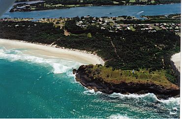
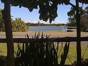
Fingal Headland and the Tweed River
|
|
| Population | 615 (2021) |
| LGA(s) | Tweed Shire |
| Region | North Coast |
Fingal Head is a small village on the coast of New South Wales, Australia. It's located in the far northeast of the state, about 5 kilometers (3 miles) south of the border with Queensland. People often just call it Fingal.
The headland and a small island nearby, called Cook Island, were first seen by Captain James Cook in 1770. According to the 2021 Australian census, about 592 people live in Fingal Head.
Contents
Exploring Fingal Head's Geography
The Tweed River and Sand Movement
The Tweed River flows northwards near the coast. It reaches the ocean just south of Point Danger. A narrow strip of land, about 500 to 800 meters wide, runs south from the river mouth to Fingal Head. This strip is called "Letitia Spit." It was named after the first ship that entered the river in 1840.
About 500,000 cubic meters of sand move north along the coast each year. This natural process is called Longshore drift. This sand used to block the entrance to the Tweed River. To fix this, the New South Wales government started the Tweed Sand Bypassing project. This project uses pumps to move sand from south of the river to northern beaches, keeping the river mouth clear.
How Fingal Head Was Formed
The headland of Fingal Head, Cook Island, and the Danger Reefs were all created by ancient lava flows. This lava came from the Tweed Volcano, which is now extinct. The rocks in this area are mostly basalt or andesite. You can find walking tracks all over this interesting area.
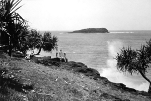
About 500 meters (1,640 feet) offshore from the headland is Cook Island. It's a rocky island where no one lives. Captain James Cook first mapped it in 1770.
The Giants Causeway of Fingal Head
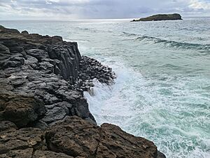
On the north-east side of Fingal Head, you can see amazing interlocking basalt columns. These columns look like the famous "Giants Causeway" found in Northern Ireland and Western Scotland. They are a natural wonder formed by volcanic activity.
The Fingal Caves, which were on the south side of Fingal Head, were destroyed in the early 1900s. Their rocks were used to build the Tweed River breakwater. Cook Island became a marine reserve in 1998. This means fishing is not allowed in the waters around it to protect marine life.
Fingal Head's Past
Early Explorers and Naming
For many years, there has been discussion about how Fingal Head got its name. Some evidence suggests that Captain James Cook actually named this spot "Point Danger" in May 1770.
In 1823, John Oxley was sailing north from Port Macquarie. He found shelter from strong winds near a "Bold Headland." He also discovered a "considerable river" nearby, which is now the Tweed River. Oxley and John Uniack explored Cook Island, which they called "Turtle Island" because they found sea turtles there.
In 1828, Captain Henry John Rous mapped the Tweed River. A map from 1831 showed the island as "Cook's Isle" and the river as the "Clarance River." The headland north of the river was also named Point Danger.
How Fingal Head Got Its Name
The name "Fingal Head" was given by Surveyor Robert Dixon in 1840. He was mapping the coastal areas between Brisbane and the Brunswick River. His map, published in 1842, was the first to show "Fingal Head." It's very likely that Dixon named it after Fingal's Cave in Scotland. This Scottish cave also has amazing columnar basalt rock formations, just like Fingal Head.
Local Aboriginal People
The traditional owners of the land around Fingal Head are the Minjungbal Aboriginal people. When white settlers arrived in the late 1800s and early 1900s, it brought big changes and challenges for the local Aboriginal population.
Post Office History
Fingal Head got its first telegraph office in October 1911. Then, a Post Office officially opened on March 15, 1912.
People of Fingal Head
In the 2011 census, Fingal Head had 544 people. About 48% were female and 52% were male. The average age of people in Fingal Head was 42 years old. This was a bit older than the national average of 37.
Most people (77%) living in Fingal Head were born in Australia. Other countries of birth included England (3.1%) and New Zealand (2.8%). Most people (88.8%) spoke only English at home.
Fingal Head Lighthouse
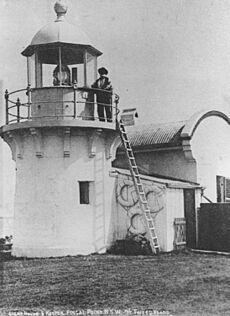
A temporary light station was set up on the headland in 1872. Then, in 1878, a proper lighthouse was built. It was made of sandstone and had a round shape. This lighthouse was one of five similar ones built between 1878 and 1880.
The tower itself is only seven meters (23 feet) tall. But because it's on top of the headland, the light shines from 24 meters (79 feet) above sea level. In 1920, the light source was changed from kerosene to acetylene gas, and it became automated. This meant it could run by itself without a keeper. In 1980, it was updated again to use electricity.
The light flashes once every five seconds. It shows a red light in the eastern direction and white light in all other directions.
Surfing at Fingal Head
Since 1996, Fingal Head has hosted an annual surfing competition for Indigenous surfers. The very first year, 90 surfers from all over Australia came to compete.
In 1999, SBS television made a documentary about this competition. It was called Surfing the Healing Wave and was part of a series about reconciliation in Australia. The documentary won an award for Best Australian Documentary in 2000.
Fingal Head is not famous for its surfing waves like some other places. The headland doesn't create special "point breaks" for surfing. However, the southern side of Fingal Head is one of the few spots near the Gold Coast that offers some protection from strong northerly winds. This makes it a good place for beach breaks when the wind is blowing from the north.


