Tweed River (New South Wales) facts for kids
Quick facts for kids Tweed River |
|
|---|---|
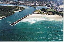
View of Tweed River mouth and Duranbah Beach.
|
|
| Other name(s) | South Arm Tweed River, Jerrys Creek |
| Country | Australia |
| State | New South Wales |
| Region | New South Wales North Coast (IBRA), Northern Rivers |
| LGA | Tweed |
| City | Murwillumbah, Tweed Heads |
| Physical characteristics | |
| Main source | McPherson, Burringbar, Condong and Tweed ranges near Lillian Rock 169 m (554 ft) |
| River mouth | Coral Sea, South Pacific Ocean Point Danger 28°10′10″S 153°33′23″E / 28.16944°S 153.55639°E |
| Length | 78 km (48 mi) |
| Basin features | |
| Basin size | 1,055 km2 (407 sq mi) |
| Tributaries |
|
| National park | Wollumbin National Park |
The Tweed River is a beautiful river in the Northern Rivers area of New South Wales, Australia. It flows into the ocean through a wide, sandy opening called an estuary. This estuary is shaped by ocean waves. The border between New South Wales and Queensland is about 10 kilometers north of the river's middle part.
The river starts high up on the eastern side of the Great Dividing Range. Its water comes from the McPherson, Burringbar, Condong, and Tweed mountains. The area that collects water for the river is about 1055 square kilometers. The Tweed River flows mostly northeast. It is joined by eight smaller rivers and creeks, including the Oxley and Rous rivers. Finally, it reaches the Coral Sea in the Pacific Ocean, just south of Point Danger. The river drops 173 meters over its 78-kilometer journey.
Along its way, the Tweed River passes through important towns like Murwillumbah and Tweed Heads.
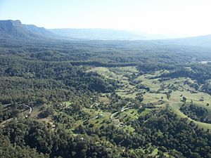
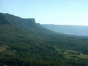
The land around the river was formed by a giant, ancient volcano. This volcano is now extinct, and Mount Warning is what's left of its central part. The Tweed River area has a warm, sunny climate with lots of rain. The soil is very rich because of the old volcano. This area used to be covered in thick rainforests. Most of these forests have been cleared, but some parts are protected in national parks. The flat lands along the river are used for growing sugar cane and other crops.
The area around the river is called Tweed Shire. Many fun water events happen on the river each year. The lower parts of the Tweed River are great for fishing. Other popular activities include waterskiing, pleasure boating, and rowing.
Contents
River History
First People of the Tweed River
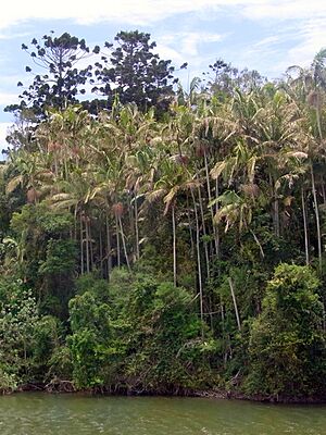
The original owners of the land around the Tweed River are the Aboriginal people. These include the Tulgi-gin, Cudgenburra, and Mooburra nations. The Yugembah language was spoken in this area. This language was used in places like the Tweed River Valley, Gold Coast, and other nearby regions.
European Discovery and Naming
The first European to see the Tweed River was John Oxley in 1823. He was a surveyor who explored the area. He wrote in his notebook about finding a "considerable river" near Point Danger.
Another person with Oxley, John Uniack, also wrote about their discovery. He described the rocky island near the river's mouth. He noted that the rocks looked like they came from a volcano. Uniack also wrote that they named the river 'Tweed'. They named it after the River Tweed in Scotland.
Later, in 1828, Captain Henry Rous explored the river more. He mistakenly thought a different point was Cook's Point Danger. He also called the Tweed River the 'Clarance River' at first.
Changing the River Mouth
In 1891, the first walls were built at the river's mouth to help keep the channel deep. These walls were made longer in 1962. However, this caused problems. Sand stopped moving naturally along the coast to the north. This led to serious erosion on the beaches of the southern Gold Coast.
To fix this, a special sand bypass system was started in 2001. This system collects sand and pumps it under the Tweed River to the beaches in Queensland. This helped the beaches return to how they were before the 1960s. The river entrance is also regularly dredged to keep it clear for boats.
"North of the Tweed"
Even though parts of the Tweed River are in New South Wales, people often use the phrase "North of the Tweed" to talk about Queensland. Similarly, people from Queensland say "South of the Tweed" to mean the southern states of Australia. This saying probably comes from people driving along the Pacific Highway for holidays. The Tweed River is the last big river they cross before reaching the Gold Coast in Queensland.
River's Path
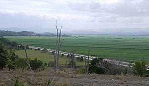
The Tweed River starts northwest of a small village called Lillian Rock. As it flows, it passes through other small villages like Kunghur, Terragon, and Uki. South of Mount Warning, creeks like Doon Doon Creek and Perch Creek join the Tweed. Byrill Creek also joins the river near Terragon.
Further downstream, Korumbyn Creek and the Oxley River flow into the Tweed near Byangum. The river then goes through Murwillumbah. At Tumbulgum, the Rous River adds its water to the Tweed. Closer to the ocean, Terranora and Cobaki creeks also join the river. The Pacific Highway crosses the river south of Banora Point.
The ocean's tides affect the river all the way up to Bray Park Weir. The Tweed River's estuary is a very important home for many shorebirds.
Flooding Events
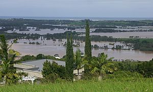
The Tweed River has experienced major floods. In 2013, during Cyclone Oswald, the river flooded badly. It reached 3.3 meters, which was the highest level in 30 years at that time.
In March 2017, heavy rain from Ex-Tropical Cyclone Debbie caused another big flood. The river gauge in Murwillumbah recorded a peak of 6.2 meters.
River Mouth
At the mouth of the Tweed River, there is a sand bypassing system. This system has a long structure called a jetty on the northern side of Letitia Spit. It collects sand and then pumps it under the Tweed River. This sand is sent to beaches in Queensland, like Duranbah Beach, Snapper Rocks, Greenmount, and Kirra. This helps keep the beaches healthy. The river entrance is also regularly dredged to make sure boats can pass through easily. The mouth of the Tweed River is about 150 meters wide.
 | Jewel Prestage |
 | Ella Baker |
 | Fannie Lou Hamer |


