Point Danger (Tweed Heads) facts for kids
Quick facts for kids Point Danger |
|
|---|---|

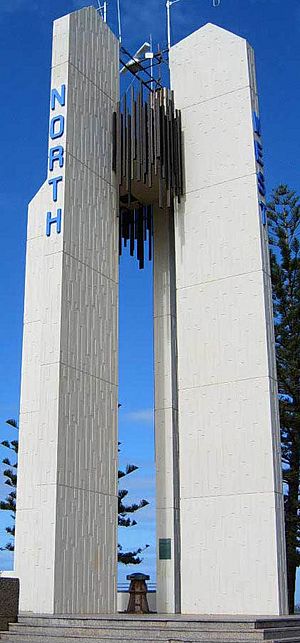
Point Danger lighthouse
|
|
| Location | Coolangatta, Queensland Tweed Heads, New South Wales |
| Coordinates | 28°10′00″S 153°33′00″E / 28.16667°S 153.55000°E |
| Offshore water bodies | Coral Sea |
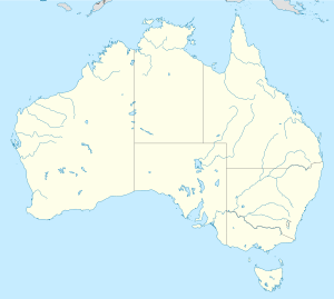
Point Danger is a headland, which is a piece of land that sticks out into the sea. It is located at Coolangatta on the southern end of the Gold Coast in eastern Australia.
Point Danger is special because it marks the border between New South Wales and Queensland, Australia. This border has been in place since 1863. The headland is near Snapper Rocks and Rainbow Bay to the west, and Duranbah Beach and the Tweed River to the south.
At Point Danger, you can find the Captain Cook memorial and lighthouse. There is also the Centaur Memorial and Walk of Remembrance. The Marine Rescue NSW station is here too. It is also the southern end of the Gold Coast Oceanway, a path along the coast.
The Centaur Memorial remembers the sinking of the Australian Hospital Ship Centaur. A Japanese submarine sank it on 14 May 1943 during World War II. The Walk of Remembrance has plaques that remember other ships lost during the war. These plaques are arranged in a circle around the lookout area.
Contents
History of Point Danger
Captain Cook's Discovery
Captain James Cook was exploring the eastern coast of Australia in 1770. On 16 May 1770, his ship, the Endeavour, came across some dangerous reefs. These reefs were about 3 nmi (about 5.5 km) east of Fingal Head. To avoid these reefs, Cook had to steer his ship away from the coast.
The next morning, Cook wrote about the reefs in his logbook. He named the land near these reefs "Point Danger." He wrote that the reefs lay "two Leagues from a point under which is a small Island." He also mentioned a "peaked mountain" inland, which he named Mount Warning. The reefs are now known as Danger Reefs.
Confusion Over the Location
For many years, people debated the exact location of the "Point Danger" that Captain Cook named. In 1823, a government surveyor named John Oxley explored the area. He thought that Fingal Head was the Point Danger that Cook had named.
Later, in 1828, Henry John Rous explored the coast. He named the area where Point Danger is today as Cook's Point Danger. This was different from what Oxley had said.
In 1840, Robert Dixon was tasked with mapping the border between New South Wales and Queensland. He used Rous's idea of Point Danger's location, not Oxley's. This is why the border ends at the current Point Danger.
The Official Decision
In 1970, a memorial and lighthouse were built at the current Point Danger. This was to mark 200 years since Cook named the point. However, the debate about the true location continued.
In 1971, the Geographical Names Board looked into the matter. They decided that Cook probably named Fingal Head as Point Danger. But because the current Point Danger had been known by that name for over 130 years, they kept the name there. This was also because the Queensland-New South Wales border was linked to its current position.
Even after this decision, the discussion continued for many years. In 2008, the official records for Point Danger and Fingal Head were changed. They now show both the historical ideas about where Cook's Point Danger was. This means that while the border is at the current Point Danger, many historians believe Cook originally named Fingal Head.
Point Danger Lighthouse
The lighthouse at Point Danger was finished in 1971. It is part of the Captain Cook Memorial. This lighthouse has a very modern design.
When it was first built, it was the first lighthouse in the world to try using lasers to make its light beam stronger. However, this experiment did not work well. So, the lighthouse went back to using regular electric lamps.
The lighthouse sends out two white flashes every ten seconds. Its light is 44.5 meters above sea level. The light is managed by NSW Maritime.
 | May Edward Chinn |
 | Rebecca Cole |
 | Alexa Canady |
 | Dorothy Lavinia Brown |


