Mount Warning facts for kids
Quick facts for kids Mount Warning |
|
|---|---|
| Aboriginal: Wollumbin | |

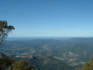
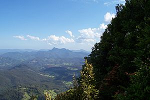
Mount Warning panorama from the summit platform
|
|
| Highest point | |
| Elevation | 1,159 m (3,802 ft) |
| Prominence | 952 m (3,123 ft) |
| Geography | |
| Location | Northern Rivers, New South Wales, Australia |
| Parent range | Tweed Range |
| Geology | |
| Age of rock | Over 23 million years |
| Mountain type | Volcanic plug |
| Last eruption | ~23 Ma |
| Climbing | |
| Easiest route | Walking track |
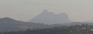
Mount Warning (Bundjalung: Wollumbin) is a famous mountain in New South Wales, Australia. It's part of the Tweed Range in the Northern Rivers area. This mountain was once the central part of a huge, ancient Tweed Volcano.
Mount Warning is located about 14 kilometers (9 miles) west-south-west of Murwillumbah. It's also quite close to the border between New South Wales and Queensland. The mountain was first seen by a European, Lieutenant James Cook, from the sea. He later named it Mount Warning.
Contents
The Ancient Volcano
Mount Warning is what's left of a giant, old shield volcano called the Tweed Volcano. Imagine a volcano that was once about 1,900 meters (6,200 feet) tall! That's almost twice as high as Mount Warning is today. This super old volcano last erupted around 23 million years ago.
When the volcano's main opening, called the central vent, cooled down, it shrunk. This created a dip at the top that has worn away over millions of years.


Today, the huge area that was once part of this volcano includes many mountains. You can find ranges like the Border Ranges, Tamborine Mountain, and the McPherson Range. It also includes the Lamington Plateau and Springbrook Plateau. The large, bowl-shaped area around Mount Warning is called an erosion caldera. It forms the edge of the beautiful Tweed Valley.
During the last eruptions, some types of lava were tougher and cooler. These harder rocks stayed behind to form the peak we see today. The entire central part of Mount Warning was also pushed up by strong forces even after the lava stopped flowing.
Wollumbin: A Special Place for Aboriginal People
The Bundjalung people call Mount Warning Wollumbin. This mountain is very important to their culture and traditions. It has sacred sites where special ceremonies are held. The top of the mountain is officially recognized as an Aboriginal Place under the National Parks and Wildlife Act.
The name Wollumbin has been spelled in different ways over time, like Walumban or Wooloombin. In 1873, it was recorded that Aboriginal people called it "Wollumbin," meaning "big fellow mountain." The stories about Wollumbin can change depending on who is telling them, their gender, or their status. Some stories say Wollumbin is a Warrior Chief, a special place for brush turkeys, or even a cloud catcher. Many more stories exist that are not shared with the public.
The name Wollumbin refers to the whole central part of the mountain and the rock formations around it.
The Bundjalung people have cultural rules that say only certain people can climb the mountain. Because of this, they ask that others also choose not to climb it. The National Parks and Wildlife Service shares this request and doesn't encourage people to hike the Mount Warning/Wollumbin Trail. However, it is not against park rules to climb it.
Naming the Mountain
In 2005, a nearby peak that was mistakenly called "Mount Wollumbin" had its name changed. This mountain is also known as Mount Ivy or Mount Dum Dum. Then, in 2006, the Geographical Names Board gave Mount Warning a dual name. This means it is now officially known as both Mount Warning and Wollumbin. The name Wollumbin refers to the entire central part of the mountain and its surrounding rock formations.
How Mount Warning Got Its Name
On May 16, 1770, Captain James Cook was the first European to write about seeing Mount Warning. He described it as "... a remarkable sharp peaked Mountain lying inland..." from a place he named Cape Byron. A few hours later, while sailing north, Cook had to change direction. He ran into dangerous reefs about 5 kilometers (3 miles) east of Fingal Head. These reefs are now called Danger Reefs.
The next morning, Cook wrote in his logbook:
"…We now saw the breakers [reefs] again within us which we past at the distance of 1 League [5 km]... The situation may always be found by the peaked mountain before mentioned which bears SWBW from them this and on this account I have named Mount Warning it lies 7 or 8 Leagues [35-40 km] inland... The point off which these shoals lay I have named Point Danger..."
Cook named the mountain Mount Warning because it helped him spot the dangerous reefs. He named the nearby land Point Danger for the same reason.
A Protected Natural Area

Mount Warning is now part of the Wollumbin National Park. The New South Wales National Parks and Wildlife Service manages access to the mountain. Mount Warning is also part of the United Nations World Heritage-listed Gondwana Rainforests of Australia. This means it's recognized as a very important natural place globally.
The Walking Track
Each year, over 60,000 people hike to the top of Mount Warning. The round trip is about 8.8 kilometers (5.5 miles) and takes around five hours. The hike starts from Breakfast Creek.
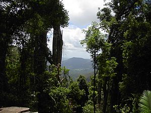
Climbing to the summit usually takes about 1½ to 3½ hours one way. You need to be quite fit to do the climb. At the very top, there are special viewing platforms. These platforms offer amazing views of the surrounding area.
 | Frances Mary Albrier |
 | Whitney Young |
 | Muhammad Ali |


