Tamborine Mountain facts for kids
Quick facts for kids Tamborine Mountain |
|
|---|---|
|
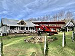
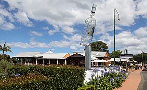
Left to right; Bavarian Grill Haus & Red Baron Brewery, The Polish Place
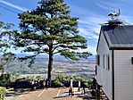
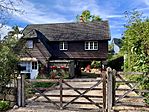
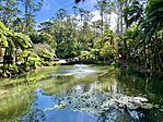
Gallery Walk, Tamborine Mountain, Tamborine Mountain Botanic Gardens |
|
| Highest point | |
| Elevation | 525 m (1,722 ft) |
| Naming | |
| Native name | Error {{native name}}: an IETF language tag as parameter {{{1}}} is required (help) |
| Geography | |
| Location | Queensland, Australia |
| Parent range | Great Dividing Range |
| Geology | |
| Age of rock | Aquitanian |
| Mountain type | Shield volcano |
| Tamborine Mountain Queensland |
|||||||||||||||
|---|---|---|---|---|---|---|---|---|---|---|---|---|---|---|---|
| Population | 8,105 (2021 census) | ||||||||||||||
| • Density | 190.71/km2 (493.9/sq mi) | ||||||||||||||
| Postcode(s) | 4272 | ||||||||||||||
| Area | 42.5 km2 (16.4 sq mi) | ||||||||||||||
| Time zone | AEST (UTC+10:00) | ||||||||||||||
| LGA(s) | Scenic Rim Region | ||||||||||||||
| State electorate(s) | Scenic Rim | ||||||||||||||
| Federal Division(s) | Wright | ||||||||||||||
|
|||||||||||||||
Tamborine Mountain is a special place in Queensland, Australia. It's a plateau, which is like a flat-topped mountain, and also a local area where people live. It's part of the Scenic Rim Region. In 2021, about 8,105 people called Tamborine Mountain home. The name comes from the Yugumbir language, meaning "wild lime tree" or "yam in a cliff."
Contents
About Tamborine Mountain
Tamborine Mountain is a plateau that covers about 28 square kilometers. It is roughly 8 kilometers long and 4 kilometers wide.
There are three main towns on the plateau: North Tamborine, Eagle Heights, and Mount Tamborine. About 5,100 people live in these towns. The area is mostly rural, meaning it has a lot of open space and nature.
People living here rely on rainwater and bores for their water. They also use septic systems for waste. Many residents travel to work in nearby cities like the Gold Coast or Brisbane.
The roads leading up to Tamborine Mountain are important. There are four ways to get to the top from the lowlands. This helps make sure people can always get in and out, even if there's flooding or road work.
How Tamborine Mountain Was Formed
Tamborine Mountain was created by lava that flowed from the Mount Warning volcano about 22 million years ago. It's part of a group of mountains in South East Queensland called the Scenic Rim.
Amazing Wildlife Habitat
Parts of Tamborine Mountain are very important for birds and other animals. This area includes wet subtropical rainforests. BirdLife International has named it an Important Bird Area (IBA). It covers about 38 square kilometers.
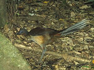
This special area is home to a unique group of Albert's lyrebirds. You can also find other cool birds like pale-yellow robins, green catbirds, regent bowerbirds, and Australian logrunners. Sometimes, you might even spot glossy black cockatoos, sooty owls, marbled frogmouths, and noisy pittas.
Beyond birds, the area is home to platypuses, short-beaked echidnas, and the beautiful Richmond birdwing butterflies.
Roads to the Mountain
A network of roads helps people get to Tamborine Mountain. These roads connect the mountain community to different areas below. They are important for keeping access open during floods or other natural events.
History of Tamborine Mountain
Aboriginal people lived on Tamborine Mountain for thousands of years. When British settlers arrived, the Wanggeriburra clan of the Yugambeh people lived here. The name "Tamborine" comes from their word Jambreen. It means "place of yams."
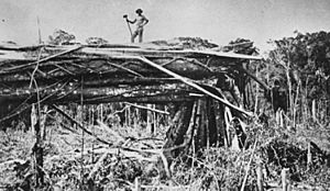
In the late 1800s, more settlers started to arrive. The mountain was covered in thick forests. It was opened for settlement in 1875. The first settlers on the mountain were John O'Callaghan and his nephew, E.H. O'Callaghan, in 1878.
In 1893, the Tambourine Mountain Provisional School opened. It later became Tamborine Mountain State School.
People started clearing land for farming. But efforts were also made to protect nature. Tamborine National Park was created in 1908. It was Queensland's first national park! Today, it has 12 separate sections of rainforest. A road for tourists to visit the mountain opened in 1924.
St Bernard State School opened in 1914.
In 1927, a group called the Queensland Country Women's Association started a branch here.
In 1990, a bus accident occurred on Henri Robert Drive. 11 people died and 38 were injured.
Tamborine Mountain College opened in 1995. Tamborine Mountain State High School opened in 1999.
Heritage Sites
Tamborine Mountain has several places listed for their historical importance:
- Geissmann Drive: Tamborine Mountain Road
- 2–4 Geissmann Street (corner of Main Street): Former Presbyterian Church
- 6–8 Main Street: Former Mountain Crest Guesthouse
- 22 Main Street: Zamia Theatre
- 386–398 Main Western Road: Tamborine Showgrounds and Hall
Schools in the Area
Tamborine Mountain has several schools for students of all ages:
- Tamborine Mountain State School is a primary school (Prep-Year 6) on Curtis Road. In 2018, it had 581 students.
- St Bernard State School is another primary school (Prep-Year 6) on School Road. In 2018, it had 238 students.
- Tamborine Mountain College is a private school for both primary and secondary students (Prep-Year 12) on Beacon Road. In 2018, it had 462 students.
- Tamborine Mountain State High School is a government high school (Years 7-12) on Holt Road. In 2018, it had 936 students.
All these schools offer special education programs for students who need extra support.
Things to Do and See
Tamborine Mountain is a popular spot for tourists.
- Gallery Walk on Long Road is famous. It's a street full of art galleries, cafes, and souvenir shops.
- Main Street also has cafes, shops, a library, and the Zamia Theatre.
- The Tamborine Showground Markets are held every second Sunday.
- The Glow-Worm Caves are a cool man-made attraction. They opened in 2006 and are located at one of the mountain's many wineries.
- You can find several nice restaurants for dining.
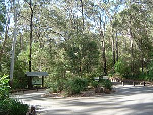
Tamborine Mountain is also known for its walking tracks through the rainforest. You can see cliffs and waterfalls.
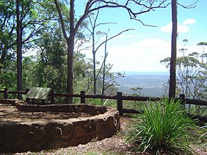
- The Curtis Falls rainforest track and The Knoll are very popular.
- The Palm Grove walk is a 30-minute walk downhill. It takes you past tall palms, mountain streams, a waterfall, and wildlife.
- The Botanic Gardens are located in Eagle Heights.
Weather and Nature
Tamborine Mountain has a subtropical highland climate. This means it's usually cooler than the areas around it.
- The average rainfall is about 1,550 mm per year. Most of the rain falls between December and March.
- Temperatures are usually 5°C to 7°C cooler than the lowlands.
- In winter, temperatures are around 17°C. In summer, they are around 25°C.
- Winters are often dry and sunny. It rarely freezes because of the thick forest.
The mountain has rich red volcanic soil and lots of rain. This helps grow many fruits like avocados, kiwifruit, passionfruit, rhubarb, apples, and mangoes. The mountain gets about 103 clear days each year.
| Climate data for Mt Tamborine | |||||||||||||
|---|---|---|---|---|---|---|---|---|---|---|---|---|---|
| Month | Jan | Feb | Mar | Apr | May | Jun | Jul | Aug | Sep | Oct | Nov | Dec | Year |
| Record high °C (°F) | 35.7 (96.3) |
35.3 (95.5) |
34.9 (94.8) |
31.4 (88.5) |
27.4 (81.3) |
26.6 (79.9) |
25.4 (77.7) |
24.9 (76.8) |
29.6 (85.3) |
35.8 (96.4) |
37.8 (100.0) |
37.8 (100.0) |
37.8 (100.0) |
| Mean daily maximum °C (°F) | 25.7 (78.3) |
25.3 (77.5) |
24.4 (75.9) |
22.6 (72.7) |
19.8 (67.6) |
17.7 (63.9) |
17.1 (62.8) |
18.3 (64.9) |
20.3 (68.5) |
22.6 (72.7) |
24.6 (76.3) |
25.9 (78.6) |
22.0 (71.6) |
| Mean daily minimum °C (°F) | 17.1 (62.8) |
17.3 (63.1) |
16.4 (61.5) |
14.0 (57.2) |
11.2 (52.2) |
9.1 (48.4) |
8.0 (46.4) |
8.6 (47.5) |
10.4 (50.7) |
12.8 (55.0) |
14.8 (58.6) |
16.3 (61.3) |
13.0 (55.4) |
| Record low °C (°F) | 11.7 (53.1) |
10.3 (50.5) |
6.9 (44.4) |
7.6 (45.7) |
3.8 (38.8) |
−0.6 (30.9) |
1.4 (34.5) |
−1.1 (30.0) |
−0.3 (31.5) |
4.7 (40.5) |
8.3 (46.9) |
9.6 (49.3) |
−1.1 (30.0) |
| Average rainfall mm (inches) | 224.6 (8.84) |
223.6 (8.80) |
190.1 (7.48) |
131.2 (5.17) |
122.5 (4.82) |
98.8 (3.89) |
82.2 (3.24) |
55.8 (2.20) |
57.1 (2.25) |
91.1 (3.59) |
120.9 (4.76) |
165.2 (6.50) |
1,563.1 (61.54) |
| Average rainy days (≥ 0.2mm) | 14.8 | 15.0 | 15.9 | 12.2 | 10.9 | 9.0 | 8.5 | 7.5 | 8.3 | 10.0 | 12.0 | 13.1 | 137.2 |
| Source: Bureau of Meteorology | |||||||||||||
 | Mary Eliza Mahoney |
 | Susie King Taylor |
 | Ida Gray |
 | Eliza Ann Grier |


