Tamborine National Park facts for kids
Quick facts for kids Tamborine National ParkQueensland |
|
|---|---|
|
IUCN Category II (National Park)
|
|
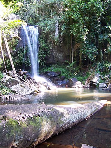
Curtis Falls in Tamborine National Park
|
|
| Established | 1993 |
| Area | 11.60 km2 (4.48 sq mi) |
| Managing authorities | Queensland Parks and Wildlife Service |
| Website | Tamborine National Park |
| See also | Protected areas of Queensland |
Tamborine National Park is a special protected area in South East Queensland, Australia. It's about 45 km (28 mi) south of Brisbane, close to the Gold Coast hinterland. This park is managed by the Scenic Rim Regional Council.
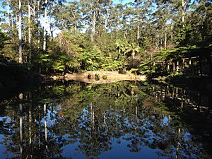
The park covers 11.60 km2 (4.48 sq mi) of land. It sits on top of and around Tamborine Mountain. The mountain's flat top, called a plateau, is about 8 km (5.0 mi) long and 5 km (3.1 mi) wide. It rises high, reaching 525 m (1,722 ft) above sea level. Being so high helps keep the temperature a bit cooler in summer. The wettest time to visit is from December to April. Winter is usually drier but also cooler.
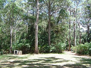
Tamborine National Park is made up of 14 separate areas. These areas are spread out and mixed in with small villages. The park offers many fun things to do. You can find picnic spots, enjoy scenic drives, and go on lots of bushwalks. These walks lead to amazing lookouts, deep gorges, tall cliffs, and beautiful waterfalls. You'll also explore different types of forests, like rainforests, wet eucalypt forests, and open woodlands.
The park is home to many interesting animals. You might spot Lyrebirds, shy platypuses, brush-turkeys, colorful lorikeets, eastern whipbirds, and satin bowerbirds. This park is super important for wildlife. It provides a home for 85% of all animal species and 65% of all plant species found in the Scenic Rim area. You cannot go Camping in the park. However, there are many places to stay nearby, like small cottages, bed-and-breakfasts, hotels, and motels.
The main parts of the park that visitors love are Joalah, Cedar Creek, The Knoll, MacDonald Park, Niche's Corner, Palm Grove, and Witches Falls. All these areas have picnic facilities and walking trails. Most have toilets, and some even have barbecues. All except Cedar Creek have information centers to help you plan your visit.
Contents
Witches Falls: Queensland's First National Park
The Witches Falls section is on the eastern side of Mount Tamborine village. This part of the park is very special because it became Queensland's first national park way back in 1908!
Exploring the Witches Falls Circuit
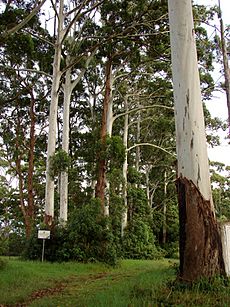
The main walk here is the Witches Falls Circuit, which is about 3 km (1.9 mi) long. This path winds down a steep slope. As you walk, you'll go through thick forests and into a lush rainforest. You'll see ancient cycad plants and huge strangler fig trees. There are also beautiful palm groves and seasonal lagoons that fill with water at certain times of the year. The trail leads you right to the falls.
Finding Your Way to Witches Falls
Another way to see the falls is by taking the Beacon Road Track. This track is 4 km (2.5 mi) one way. You can get to this area from Main Western Road. This road is also known as Tamborine Mountain Road or Geissmann Drive. The main plants you'll see here are subtropical rainforest trees, including large red cedar trees and strangler figs.
Palm Grove: A Walk Among Palms
The Palm Grove section of the park is on the western side of Tamborine Mountain village. This area is named after the many piccabeen palms that grow here. They make the area look very green and tropical.
Trails in Palm Grove
There are two main trails in Palm Grove. The Curtis Road Track is 1.2 km (0.75 mi) one way. It connects Curtis Road and Palm Grove Avenue. The Palm Grove Circuit is a 1.4 km (0.87 mi) loop. This circuit takes you through beautiful rainforests, with many fig and palm trees.
Accessing Palm Grove
You can find Curtis Road off Tambourine Mountain Road in Tamborine Mountain. Palm Grove Avenue is off Central Avenue in Eagle Heights.
Joalah: Discovering Curtis Falls
The Joalah section of the park is located between Witches Falls and Palm Grove, to the north. This area is famous for the Curtis Falls Walk.
The Curtis Falls Walk
The Curtis Falls Walk is a 1.5 km (0.93 mi) return trip. The path goes down to a rock pool right at the bottom of the falls. From here, you get amazing views of the basalt rock face behind the waterfall. You might also see brush-turkeys walking along the Joalah Circuit. This circuit is 4 km (2.5 mi) long and connects with the Curtis Falls Walk. You can get to Joalah off Eagle Heights Road.
MacDonald Park: A Garden of Rainforest Plants
MacDonald Park is also in Eagle Heights. It's right next to the Tamborine Mountain Botanic Gardens. This section of the park is a great place to learn about rainforest plants.
The Rainforest Circuit
MacDonald Park has a rainforest circuit that is 2.6 km (1.6 mi) long. What's special about this walk is that many of the plants are named. This helps you learn what you are seeing. You can get to MacDonald Park off Wangawallan Road.
The Knoll: Views and Wildlife
The Knoll section of the park is in the north-west part of North Tamborine. This area offers fantastic views and a chance to see some unique plants and animals.
Cameron Falls Circuit
The Cameron Falls Circuit is a 3 km (1.9 mi) walk in The Knoll. This trail gives you wonderful views of the area. You'll walk through rainforests and open forests. Keep an eye out for black skinks. These small lizards sometimes sunbathe on the warm rocks. Knoll Road runs off Main Street to get to this section. The Tamborine Mountains Natural History Association Information Centre is also in North Tamborine village.
Unique Trees at The Knoll
You'll find groups of forest she-oak trees at The Knoll. Another beautiful tree here is the lacebark. This is an Australian native tree known for its lovely flowers.
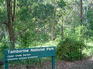
Cedar Creek: Cascades and Rock Pools
To reach Cedar Creek, head north from North Tamborine on Tamborine Mountain Road. There will be a turnoff onto Cedar Creek Falls Road. This area is one of the most delightful places to walk in the Tamborine area.
The Cedar Creek Circuit
The Cedar Creek Circuit is 3.2 km (2.0 mi) long. This walk lets you explore the creek's many cascades (small waterfalls) and rock pools. You'll also see different plant communities, like open and dry rainforests, and tall hoop pines. The falls here tumble gently into a gully, rather than being a huge, powerful waterfall. There's also a 1.5 km (0.93 mi) Rock Scree Walk that you can take as a detour from the main circuit.
Niches Corner: Amazing Gold Coast Views
Niches Corner is about 20 km (12 mi) north of The Knoll and the main part of Tamborine Mountain. This spot offers wide, amazing views looking out towards the Gold Coast.
Niches Lookout Circuit
One of the best walks in the entire Tamborine area is the Niches Lookout Circuit. This walk is 3.2 km (2.0 mi) long. It lets you explore the cascades, rock pools, and different plant communities found at Niches Corner. You'll see open and dry rainforests, as well as hoop pines.
|
See also
 In Spanish: Parque nacional Tamborine para niños
 | Frances Mary Albrier |
 | Whitney Young |
 | Muhammad Ali |


