Tamborine, Queensland facts for kids
Quick facts for kids TamborineQueensland |
|||||||||||||||
|---|---|---|---|---|---|---|---|---|---|---|---|---|---|---|---|

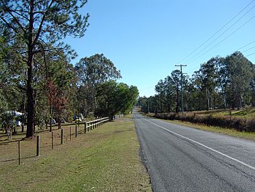
Greensward Road, 2014
|
|||||||||||||||
| Population | 4,388 (2021 census) | ||||||||||||||
| • Density | 61.63/km2 (159.6/sq mi) | ||||||||||||||
| Postcode(s) | 4270 | ||||||||||||||
| Area | 71.2 km2 (27.5 sq mi) | ||||||||||||||
| Time zone | AEST (UTC+10:00) | ||||||||||||||
| LGA(s) |
|
||||||||||||||
| State electorate(s) |
|
||||||||||||||
| Federal Division(s) | Wright | ||||||||||||||
|
|||||||||||||||
Tamborine is a country town in Queensland, Australia. It is part of the Scenic Rim Region and also a locality. This means its area is split between the Scenic Rim Region and the City of Logan. In 2021, about 4,388 people lived in Tamborine.
Contents
Exploring Tamborine's Geography
Tamborine has two smaller areas called neighbourhoods. These are Bromfleet and Plunkett.
A large part of the Tamborine National Park is located in the east of Tamborine. This park also stretches into nearby areas like Cedar Creek and Tamborine Mountain.
Important roads run through Tamborine. The Beaudesert–Beenleigh Road goes from the south-west to the north-east. The Waterford-Tamborine Road and Tamborine Mountain Road go from the north-west to the south-east.
Tamborine's Past: A Look Back
First People: The Wanggeriburra Clan
Long ago, the land around Tamborine was home to the Wanggeriburra clan. They are part of the Yugambeh people, an Aboriginal group. They called this area Tamboreen or Tchambreen. This name meant "place of yams," which are root vegetables.
Early European Settlement
In 1845, British settlers named Mr. Whitting and Hicks arrived. They took land in Tamboreen and changed its name to Burton Vale. Over time, the name of the area changed a few times. It was called Tamboreen, then Tambourine, and now it is Tamborine.
During the 1850s, many Wanggeriburra people were forced to leave their land. This happened because of actions by the Native Police.
Later, in the 1850s, Dugald Graham bought the Tambourine property. Joseph Delpratt took over in the 1870s. More people started to settle in the area. Thomas Plunkett opened a store in 1872. A post office opened two years later.
Churches and Schools in Tamborine
St Patrick's Catholic Church was built in the early 1870s. It was first located near the Albert River. There was also a cemetery nearby. But because of floods, the cemetery was moved to land given by Thomas Plunkett. In the 1960s, the church building was moved to where the old Tamborine railway station used to be. It was reopened in 1966. As of 2020, a monthly church service is still held there.
Tambourine Provisional School started in 1874. It was first held in St Patrick's Catholic Church. In 1905, the Queensland Government gave 10 acres (4.0 ha) for a new school building. This building was at 2680-2726 Waterford Tamborine Road. In 1909, it became Tambourine State School. The spelling changed to Tamborine in 1926.
Tamborine State School closed in 1970. The school building was moved to Chambers Flat. The old school site is now Tamborine School Park. The school building has been brought back to the park. It is now called "The Little School House" and is used for community meetings.
Railways and Halls
A railway line, called the Canungra railway line, opened in 1915. It connected Logan Village railway station to Canungra. This line had three stations in Tamborine:
- Plunkett railway station
- Tamborine railway station
- Bromfleet railway station
The railway line closed in 1955.
The Tamborine Memorial Hall was built in 1919. It is a place for community events.
Tamborine During World War II
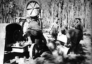
During World War II, the American Army set up a camp in Tamborine in 1942. It was first called Camp Tamborine. Later, it was renamed Camp Cable after a soldier named Gerald O. Cable. Today, this area is near Logan Village and Yarrabilba.
Tamborine used to be part of the Shire of Beaudesert. But in 2008, it was split. Now, it is part of both Logan City and the Scenic Rim Region.
Who Lives in Tamborine?
The number of people living in Tamborine has grown over the years:
- In 2011, there were 3,464 people.
- In 2016, the population was 3,950 people.
- In 2021, 4,388 people lived in Tamborine.
Historic Places in Tamborine
Tamborine has one place listed for its historical importance. It is called Tamborine House. You can find it at 869 Mundoolun Connection Road.
Learning in Tamborine
There are no schools directly in Tamborine. Students usually go to schools in nearby towns.
- For primary school, kids might go to Yarrabilba State School in Yarrabilba. They might also go to Cedar Creek State School in Cedar Creek. Another option is Tamborine Mountain State School in Tamborine Mountain.
- For high school, students can attend Yarrabilba State Secondary College in Yarrabilba. Other choices include Windaroo Valley State High School in Bahrs Scrub. Or they might go to Tamborine Mountain State High School in Tamborine Mountain.
Community Facilities
The Tamborine Rural Fire Station is at 2765-2771 Waterford Tamborine Road. This is where local firefighters are based.
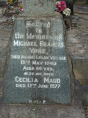
There are two cemeteries in the area:
- Tamborine Catholic Cemetery is at 83-89 Plunkett Road.
- Cedar Creek Cemetery (also called Plunkett Road Cemetery) is at 487 Plunkett Road.
Local Amenities
The Tamborine Memorial Hall is a public building. It is located at 2760 Waterford Tamborine Road. People use it for various community events.
The Scenic Rim Regional Council offers a mobile library service. A mobile library is like a library on wheels. It visits the corner of Waterford-Tamborine Road and Beenleigh-Beaudesert Road. This is opposite the Shell service station.
Tamborine also has several parks for people to enjoy:
- Cedar Creek Park
- Fred Bucholz Park
- Birnam Range Park
 | DeHart Hubbard |
 | Wilma Rudolph |
 | Jesse Owens |
 | Jackie Joyner-Kersee |
 | Major Taylor |


