Wongawallan, Queensland facts for kids
Quick facts for kids WongawallanGold Coast, Queensland |
|||||||||||||||
|---|---|---|---|---|---|---|---|---|---|---|---|---|---|---|---|

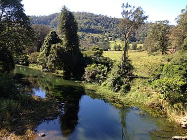
Wongawallan Creek
|
|||||||||||||||
| Population | 1,415 (2021 census) | ||||||||||||||
| • Density | 43.01/km2 (111.4/sq mi) | ||||||||||||||
| Postcode(s) | 4210 | ||||||||||||||
| Area | 32.9 km2 (12.7 sq mi) | ||||||||||||||
| Time zone | AEST (UTC+10:00) | ||||||||||||||
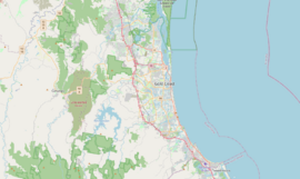
| Location |
|
||||||||||||||
| LGA(s) | City of Gold Coast | ||||||||||||||
| State electorate(s) |
|
||||||||||||||
| Federal Division(s) | Forde | ||||||||||||||
|
|||||||||||||||
Wongawallan is a small, countryside area located in the City of Gold Coast in Queensland, Australia. It is known as a rural locality. In 2021, about 1,415 people lived in Wongawallan.
Contents
Exploring Wongawallan's Landscape
Wongawallan has many mountains and hills. Most of the farms and homes are built in the valleys near creeks. The tops of the hills are usually left wild and undeveloped.
Mount Wongawallan
A special mountain called Mount Wongawallan is in the north-east part of the area. It stands tall at about 378 meters (1,240 feet) above sea level.
Creeks and Rivers
The main waterways here are Wongawallan Creek and Tamborine Creek. Tamborine Creek flows into Wongawallan Creek near Welch Pioneer Park. Wongawallan Creek then flows into the Coomera River in the nearby area of Maudsland.
Main Roads
The most important road that goes through Wongawallan is the Tamborine-Oxenford Road. It helps people travel to and from the locality.
The Story of Wongawallan's Name
The area was first called Mount Goulburn. This name was given by a surveyor named Dixon, after a person called Henry Goulburn.
Later, the name was changed to Wongawallan. Many people believe this name comes from an Aboriginal language. In this language, wonga means pigeon and walla means water. So, it might mean "pigeon water".
How Many People Live Here?
The number of people living in Wongawallan has grown over the years:
- In 2011, there were 1,103 people.
- By 2016, the population grew to 1,273 people.
- In 2021, the population reached 1,415 people.
Special Places: Heritage Sites
Wongawallan has some places that are important to its history. These are called heritage-listed sites.
- One such place is Welch Pioneer Park, located at 881 Tamborine-Oxenford Road. It is home to the grave of Elizabeth Welch.
Learning and Schools
There are no schools directly in Wongawallan. However, students can attend schools in nearby areas.
- For primary school, students often go to Highlands Reserve State School or Upper Coomera State College. Both are in Upper Coomera to the east.
- Another option is Tamborine Mountain State School, located in Tamborine Mountain to the south-west.
- For high school, students can attend Upper Coomera State College in Upper Coomera.
- They can also go to Tamborine Mountain State High School in Tamborine Mountain.
Parks and Fun Places
Wongawallan has many parks and reserves where people can enjoy nature and outdoor activities. Here are a few of them:
- Cresthill Drive Reserve
- Eagle Heights Conservation Area
- Gladrose Reserve
- Hayes Park
- Howard Creek Reserve
- Lanes Park
- Pinnacle Park
- Solomon Lane Reserve
- Tamborine Creek Reserve
- Tamborine Oxenford Road Bend Reserve
- Tamborine Recreation Reserve
- Timberview Drive Reserve
- Timberview Drive Park
- Valley View Vista Park
- Walter Park
- Waterfall Drive Northern Park
- Waterfall Drive Southern Park
- Welch Pioneer Park
- Wongawallan Conservation Area
- Wongawallan Reserve
- Wongawallan Road Reserve
- Wongawallen Junction Reserve
 | Delilah Pierce |
 | Gordon Parks |
 | Augusta Savage |
 | Charles Ethan Porter |


