Scenic Rim facts for kids
The Scenic Rim is a beautiful area of forested mountains in Australia. It's located just south of Brisbane and stretches across the border between south-eastern Queensland and New South Wales. These mountains are part of the larger Great Dividing Range.
Contents
A Look Back: History of the Scenic Rim
The Scenic Rim has a rich history, especially with Aboriginal people. Two main languages spoken here were Yugarabul and Yugembah.
Yugarabul Language
The Yugarabul language covered areas like Brisbane City, Ipswich City, and the Scenic Rim region. It's an important part of the local heritage.
Yugembah Language
The Yugembah language was spoken across a wider area. This included places like the Gold Coast, Logan, the Scenic Rim, and the Tweed River Valley. It also covered towns like Beaudesert and Tamborine.
What is the Scenic Rim?
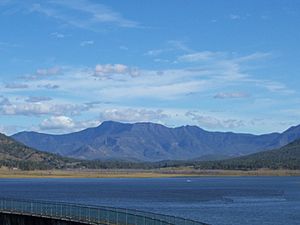
The Scenic Rim is a curved line of mountains. It stretches from south of Toowoomba all the way around to Springbrook. Key parts of this mountain range include Tamborine Mountain, Lever's Plateau, and the Lamington Plateau.
Exploring the Landscape
This area is also known as part of the Gold Coast hinterland. Some parts of the Scenic Rim are busy with roads and places for tourists. For example, Cunninghams Gap is a popular spot. Other areas are private farms or small country villages like Beechmont. A large part of the Scenic Rim is protected in national parks and nature reserves.
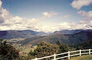
Mountains and Valleys of the Rim
The Scenic Rim is made up of several mountain ranges. These include the Little Liverpool Range, Main Range, and the McPherson Range.
Major Mountain Ranges
- Little Liverpool Range
- Main Range
- Mistake Mountains
- McPherson Range
- Teviot Range
- Tweed Range
Beautiful Valleys
Between these mountains are many fertile valleys. Some of the well-known valleys include:
- Laidley Creek
- Christmas Creek
- Lockyer Valley
- Fassifern Valley
- Numinbah Valley
- The Albert River valley
- Logan River valley
- Coomera River valley
- Bremer River valley
Environment and Nature
The Scenic Rim's landscape was mostly formed by ancient volcanoes. These include the huge Tweed Volcano and the Focal Peak and Main Range volcanoes. Some areas also have rocks formed from ancient sediments.
Unique Ecosystems
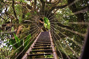
The soils here are rich and mostly made from volcanic rock. They support amazing rainforests and thick vine forests. You can also find rare eucalypt trees and grasslands.
Climate of the Region
The area has a subtropical climate. This means it has warm, wet summers and mild winters. In the lower areas, winter temperatures average around 6°C. Summer temperatures can reach about 29°C. The area gets a lot of rain, averaging about 1555 mm each year.
Protecting Nature: National Parks
Many parts of the Scenic Rim are protected to keep their natural beauty safe. These protected areas include many national parks and conservation reserves.
Key Protected Areas
- Border Ranges National Park
- Glen Rock Regional Park
- Koreelah National Park
- Lamington National Park
- Limpinwood Nature Reserve
- Main Range National Park
- Mebbin National Park
- Moogerah Peaks National Park
- Mount Barney National Park
- Mount Chinghee National Park
- Mount Clunie National Park
- Mount Nothofagus National Park
- Mount Warning National Park
- Numinbah Nature Reserve
- Springbrook National Park
World Heritage Status
Some parts of the Scenic Rim are part of the Gondwana Rainforests of Australia. These ancient rainforests are so special that they are listed as a World Heritage Site. This means they are important to the whole world! Some areas are also called Wilderness Areas, which means they are kept as wild and untouched as possible.
An Important Bird Area
The Scenic Rim is recognized as an Important Bird Area (IBA) by BirdLife International. This is because it's a vital home for many different bird species. The IBA covers a large area of about 1351 square kilometers.
Special Birds of the Scenic Rim
This area helps protect populations of several rare and endangered birds. These include:
- Eastern bristlebirds
- Black-breasted button-quails
- Rufous scrub-birds
- Albert's lyrebirds
- Pale-yellow robins
- Paradise riflebirds
- Green catbirds
- Regent bowerbirds
- Australian logrunners
There have also been sightings of the critically endangered Coxen's fig parrot. This bird is very rare and needs special protection.
Fun for Visitors: Tourism
The Scenic Rim is a popular place for people to visit and enjoy nature. There are many activities for day-trippers, rockclimbers, hikers, and anyone who loves the outdoors.
How Tourism Began
The idea of the "Scenic Rim" was first described in the 1920s by Arthur Groom and Romeo Lahey. They worked hard to protect the forests from the Main Range to the Lamington Plateau. Around the same time, places like the Binna Burra Lodge and O'Reilly's Guesthouse were built. This helped more tourists discover the beauty of the area.
 | DeHart Hubbard |
 | Wilma Rudolph |
 | Jesse Owens |
 | Jackie Joyner-Kersee |
 | Major Taylor |


