Lockyer Valley facts for kids
Quick facts for kids Lockyer Valley |
|
|---|---|
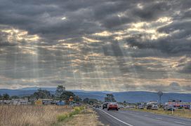
Warrego Highway looking towards Toowoomba
|
|
| Area | 2,272 km2 (877 sq mi) |
| Geography | |
| Country | Australia |
| State | Queensland |
| Region | South East Queensland |
| River | Lockyer Creek |
The Lockyer Valley is a very rich farming area in Queensland, Australia. It is located west of Brisbane and east of Toowoomba. This valley is known as one of the top ten most fertile farming areas in the world.
Farmers here grow a huge variety of fruits and vegetables. In fact, it grows more different kinds of produce than any other area in Australia! Because of this, people often call the Lockyer Valley "Australia's Salad Bowl."
More and more people are moving to the Lockyer Valley. It offers a nice country lifestyle and homes are more affordable. To protect the valuable farmland, special plans have been made. These plans try to make sure new buildings are built on hillsides, not on the best farming land.
Contents
Exploring the Lockyer Valley's Geography
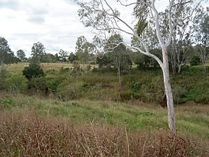
The Lockyer Valley is surrounded by the Great Dividing Range on both sides. It is part of the Lockyer Valley Region local government area.
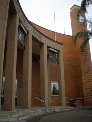
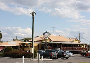
The biggest town in the valley is Gatton. Other important towns include Laidley, Withcott, and Plainland. You can also find smaller places like Hatton Vale, Helidon, Forest Hill, Grantham, and Murphys Creek.
Rivers and Waterways
The main river in the valley is Lockyer Creek. Many smaller streams flow into it. Lockyer Creek then joins the Brisbane River, which eventually flows into Moreton Bay. Many of these creeks only flow after it rains.
The valley has a few small dams to store water. These include Atkinson Dam, Bill Gunn Dam, and Lake Clarendon.
A Glimpse into Lockyer Valley's History
The Lockyer Valley was originally home to the "Kitabul People." Later, the Ugarapul People became the traditional owners of this land.
Early European Settlement
One of the first Europeans known to the local Indigenous people was "Boralcho" Baker. He lived with the Jagera people for 18 years, starting in 1826. In 1827, an explorer named Allan Cunningham also explored the area.
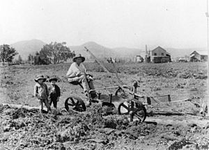
In the 1830s, people started getting licenses to use land for farming. From 1840, farmers began clearing land to raise animals like sheep. The Indigenous people's traditional food sources became harder to find. This caused great hardship for them.
The town of Gatton was officially created in 1855. This makes it one of Queensland's oldest European settlements. Many German immigrants also came to live in the valley.
Transport and Development
The first train line in the valley opened in 1865. It connected Ipswich to Grandchester. A small timber industry also grew around this time.
In 1960, an earthquake shook the valley, damaging some buildings. A railway line called the Laidley Valley railway line operated between 1922 and 1960. However, it was never very busy.
In 1994, a special area called Berlin Scrub Nature Refuge was created. It was the first land protected under a new law to save nature.
Understanding Lockyer Valley's Climate
The Lockyer Valley is the driest part of South East Queensland. It gets about 780 mm of rain each year. The amount of rain can change a lot, and droughts happen often.
In summer, the Lockyer Valley is usually hotter than Brisbane. In winter, it is colder.
Major Flooding Events
The valley has experienced severe floods. In November 2008, heavy floods caused farmers to lose all their crops. Livestock also died, and one person lost their life.
Even worse floods happened in January 2011. The towns of Withcott and Grantham were hit very hard. Many people died in places like Spring Bluff, Murphys Creek, Grantham, and Postmans Ridge. Many bridges were destroyed or badly damaged. The cost to fix roads and drains was estimated to be very high.
To help with future floods, a special camera system was installed in 2012. It uses radar and solar power to detect when creek water levels rise quickly. The cameras are placed high up to avoid damage. They send real-time pictures to the council's disaster center.
Farming in the Lockyer Valley
Farming is the main activity in the Lockyer Valley. Farmers grow many different crops and raise animals. They grow grains and a lot of vegetables. They also grow turf (grass for lawns) and lucerne, which is food for dairy cows and racehorses.
Most of the water for farming comes from underground. Farmers in the valley produce about 40% of all the fresh vegetables eaten in South East Queensland. Most farms are not huge, usually between 100 and 1,000 hectares.
Rich Soils and Water Challenges
The valley has very fertile black soils. These soils help support a vegetable industry worth $160 million each year. However, the changing climate and farming all year round put a lot of pressure on the underground water supply.
Sometimes, farming in the Lockyer Valley can be difficult. Unreliable rain, pests, and damage from bad weather can reduce how much farmers can grow. Some farmers now use lasers to make sure their watering systems work perfectly. This helps them get the best possible crops.
Recycled wastewater from a special scheme could be used for watering crops. The pipes are already there, but it is currently too expensive to use.
Key Crops
Almost all the beetroot used for processing in Australia is grown in the Lockyer Valley. In 2002, only eight farms were growing beetroot for this purpose. Companies like Golden Circle get their vegetables from the Lockyer Valley.
 | Bessie Coleman |
 | Spann Watson |
 | Jill E. Brown |
 | Sherman W. White |


