Fire Scale Mountain facts for kids
Quick facts for kids Fire Scale Mountain |
|
|---|---|
| Highest point | |
| Elevation | 3,845 ft (1,172 m) |
| Geography | |
| Location | Watauga County, North Carolina, U.S. |
| Parent range | Blue Ridge Mountains |
| Topo map | USGS Maple Springs |
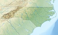
Fire Scale Mountain is a cool mountain located in the western part of North Carolina, in a region known as the High Country. It's close to a small town called Deep Gap. This mountain is quite tall, reaching about 3,845 feet (or 1,172 meters) into the sky!
Most of Fire Scale Mountain is actually inside the Blue Ridge Parkway. This is a famous scenic road that winds through the Blue Ridge Mountains.
Contents
About Fire Scale Mountain
Fire Scale Mountain is an important part of the Blue Ridge Mountains range. It's a great place to learn about how mountains shape the land. The mountain's elevation makes it a significant landmark in the area.
Where is Fire Scale Mountain?
This mountain is found in Watauga County, North Carolina, in the United States. It's part of the beautiful Blue Ridge Mountains. The area around it is known for its stunning views and outdoor activities.
Water and Rivers
Fire Scale Mountain sits right on something called the Eastern Continental Divide. Imagine a line across the land where rainwater on one side flows towards the Atlantic Ocean, and water on the other side flows towards the Gulf of Mexico. That's what a continental divide does!
Because of this divide, streams starting on Fire Scale Mountain flow in different directions. Some small streams, like Gap Creek, feed into the South Fork New River. Other streams, like Stony Fork, flow into the Yadkin River. It's pretty neat how one mountain can send water to different major rivers!
Important Roads and Gaps
There's a part of the mountain called Ivy Point Ridge. This ridge stretches out from the mountain towards the southeast. A major road, US 421, uses this ridge. It helps the road go from the lower "Foothills" region up into the "Mountains."
Right next to Fire Scale Mountain is a natural dip in the land called Deep Gap. This gap is important because it's where the Blue Ridge Parkway and US 421 meet. The nearby community of Deep Gap also gets its name from this natural feature.
 | Sharif Bey |
 | Hale Woodruff |
 | Richmond Barthé |
 | Purvis Young |


