First Parish Church Site-Dover Point facts for kids
Quick facts for kids |
|
|
First Parish Church Site-Dover Point
|
|
 |
|
| Location | Dover Point Rd., Dover, New Hampshire |
|---|---|
| Area | 0.4 acres (0.16 ha) |
| Built | 1653 |
| Architect | Walderne, Richard |
| NRHP reference No. | 83001153 |
| Added to NRHP | May 27, 1983 |
The First Parish Church Site-Dover Point is a special historical place in Dover, New Hampshire. It's where the second church building of the First Parish Church once stood. This church group started way back in 1633. The building itself was put up in 1653. It was later taken down in the 1700s. What makes this site unique is that it was built like a fort! It had strong log walls and earth mounds to protect people from attacks. This old church site was added to the National Register of Historic Places in 1983, which means it's an important historical landmark.
Contents
A Look Back at Dover Point's History
Dover Point is a piece of land in the very south of Dover. It separates the Piscataqua River from the Bellamy River and the Great Bay. The first settlers of Dover arrived here from Salem, Massachusetts in 1633. They built their first church building, called a colonial meeting house, right at the tip of the point. Sadly, that first site was later covered up when the Spaulding Turnpike was built.
Building the Second Meetinghouse
The second meetinghouse was built a bit further north on Dover Point in 1653. This spot was closer to where the settlers had created their first village. This new church building was about 40 feet (12 meters) long and 26 feet (8 meters) wide.
A Fortified Church for Protection
Between 1667 and 1675, something very important happened to the meetinghouse. It was turned into a fortified (protected) building. Workers built a large dirt wall, called an embankment, around it. On top of this wall, they placed a strong fence made of logs, known as a palisade. This defense system helped keep the community safe during a conflict called King Philip's War. It seems the fortifications worked well!
The Church's Later Years and Rediscovery
In 1713, a brand new meetinghouse was built at "Pine Hill." This area is now the center of Dover. Services at the Dover Point location stopped around 1720. The old building was taken down later in the 1700s, and the site was left empty.
Even though the building was gone, people still remembered where it was. Its location was written down in local history books. Then, in 1889, the land was given back to the original church group. They have taken care of the site ever since.
What You Can See at the Site Today
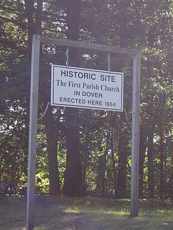
The First Parish Church Site is on the west side of Dover Point Road. It's across from where Forsythia Drive meets the road. You can spot it by a sign. The side of the site facing the road has a low stone wall.
The grassy area of the site covers where the church's foundations once were. You can also still see the earthworks, which are the remains of the dirt walls that surrounded the church. These earthworks formed a rough rectangle. There were also parts that stuck out at two of the corners. These sticking-out parts were where elevated observation posts, called sconces, were built. From these posts, people could watch for danger.
See Also
 | Delilah Pierce |
 | Gordon Parks |
 | Augusta Savage |
 | Charles Ethan Porter |


