Flatiron Mountain (Idaho) facts for kids
Quick facts for kids Flatiron Mountain |
|
|---|---|
| Highest point | |
| Elevation | 11,019 ft (3,359 m) |
| Prominence | 499 ft (152 m) |
| Parent peak | Big Creek Peak |
| Geography | |
| Location | Lemhi County, Idaho, U.S. |
| Parent range | Lemhi Range |
| Topo map | USGS Big Creek Peak |
| Climbing | |
| Easiest route | Scramble, class 3 |
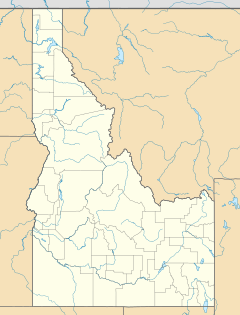
Flatiron Mountain is a tall peak located in the Lemhi Range in Idaho, USA. It stands about 11,109 feet (3,386 m) above sea level. This means it is very high up from the ocean's surface. The mountain is found in Lemhi County. It sits right on the edge of two large natural areas: the Caribou-Targhee National Forest and the Salmon-Challis National Forest. Flatiron Mountain is also quite close to another peak, Big Creek Peak, which is about 1.1 mi (1.8 km) to its southeast.
Contents
What is a Mountain?
A mountain is a very large landform that rises high above the land around it. Mountains are usually steeper than hills. They are often formed by the Earth's tectonic plates pushing against each other. This process slowly pushes the land upwards over millions of years.
How Mountains are Measured
Mountains are measured in different ways. One common way is by their elevation. This is how high the mountain's top is above sea level. Flatiron Mountain's elevation is over 11,000 feet. Another measurement is prominence. This tells you how much a mountain stands out from the land around it. It measures the height from the lowest point connecting it to a higher peak.
The Lemhi Range
Flatiron Mountain is part of the Lemhi Range. A mountain range is a group of mountains that are connected. They often share a similar geological history. The Lemhi Range is a long mountain chain in eastern Idaho. It is known for its rugged beauty and remote areas.
Exploring Mountain Ranges
Mountain ranges like the Lemhi Range are important for many reasons. They provide homes for different plants and animals. They also store snow and ice that melt into rivers, providing water. People enjoy visiting mountain ranges for hiking, climbing, and exploring nature.
National Forests Nearby
Flatiron Mountain is located between two important national forests: the Caribou-Targhee National Forest and the Salmon-Challis National Forest. National forests are large areas of land managed by the government. They are set aside for many uses, like protecting wildlife, growing trees, and offering outdoor recreation.
Caribou-Targhee National Forest
The Caribou-Targhee National Forest is a vast area in eastern Idaho and western Wyoming. It is known for its beautiful landscapes and diverse wildlife. This forest is a popular spot for camping, fishing, and hiking. It helps protect important natural resources.
Salmon-Challis National Forest
The Salmon-Challis National Forest is another huge forest in central Idaho. It covers a large area of mountains, rivers, and wilderness. This forest is home to many animals, including elk, deer, and bears. It offers many chances for outdoor adventures.
Climbing Flatiron Mountain
The easiest way to reach the top of Flatiron Mountain is by a route called a "scramble." Scrambling is a type of climbing that is harder than hiking but easier than rock climbing. It often involves using your hands to help you move over steep, rocky terrain.
Understanding Climbing Difficulty
Climbing routes are often rated to show how difficult they are. The route up Flatiron Mountain is rated class 3. This rating comes from the Yosemite Decimal System (YDS). A YDS 3 rating means it's a relatively easy scramble. It might involve some simple climbing moves, but usually no ropes are needed. It's important to be careful and prepared when trying any scramble.


